Baltic/Brilliant Cycling in Estonia *

*delete as appropriate

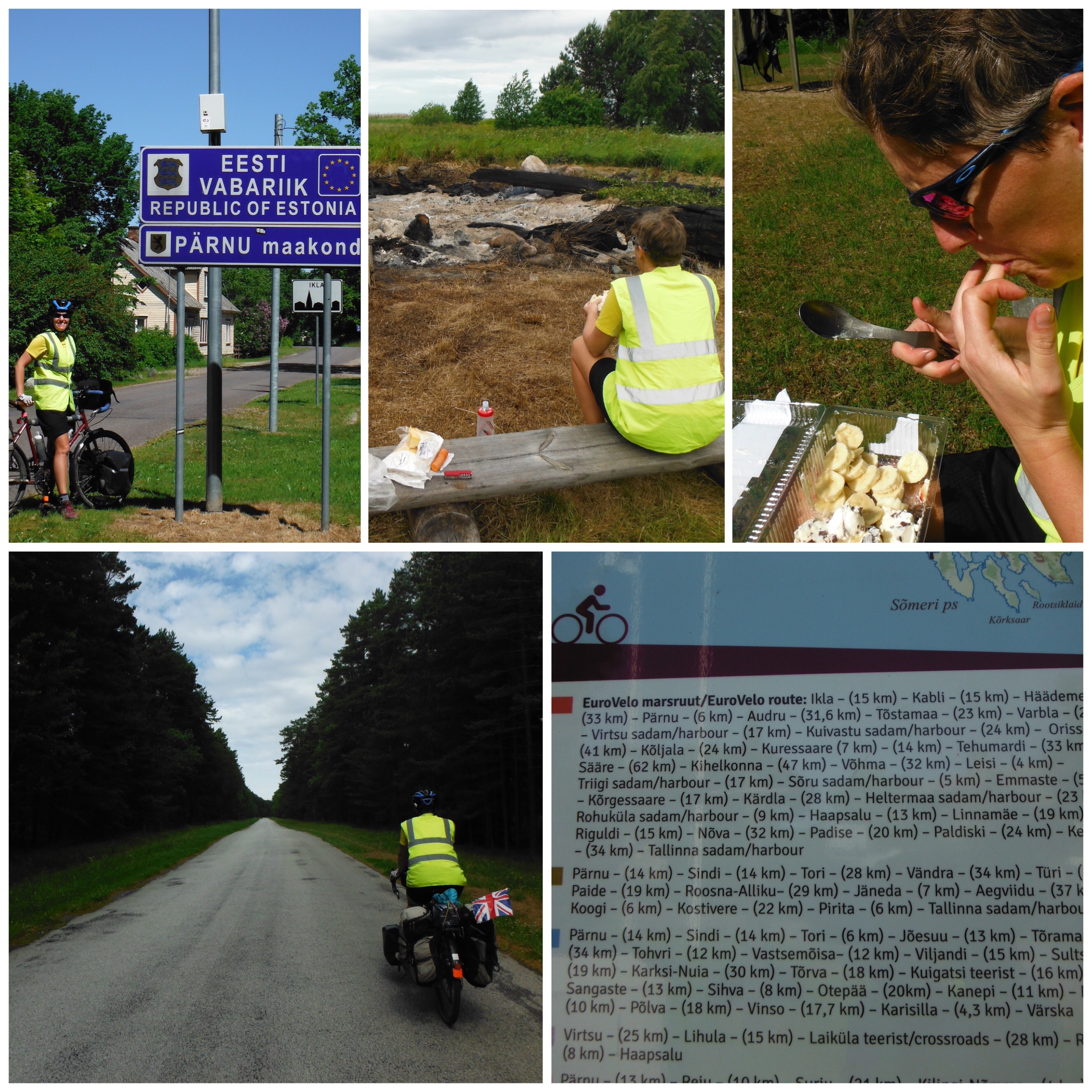
At the risk of repeating myself from previous posts, even in Schengen Europe where borders are just ‘Welcome to’ signs at the side of the road, there are usually instantly noticeable differences when you cross into a new country. In Estonia, people waved to us and smiled. This was a marked difference to the previous week (sorry Latvia) where one of our best interactions was with the old lady who was worried about our cold forearms outside a shop that didn’t look like a shop. In the first large town in Estonia, one group of people waved and cheered so vigorously that they nearly fell off their seats. They were outside a bar though, and there was a lot of empty glasses on the table. There was a helpful map of bike routes with distances., and even better a sudden increase in availability and quality of public toilets. Not exciting or glamorous, but extremely useful. On the downside, cheese had somehow doubled in cost. The cheese fiend half of our team was very disappointed.

Clockwise from top left: 1. Welcome! 2. Remains of midsummer partying. 3. A whole cake to make up for the lack of cheese. 4. Actual bike routes, not beaches. 5. Quiet roads.

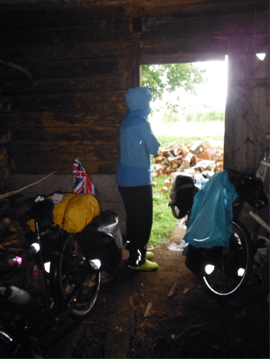
Keen to continue its new reputation for stimulating encounters, on day two Estonia gave us all of the weather. All of it. Except snow. The wind blew strongly all day with unpredictable gusts. After 2 hours and 13km we sat in a bus stop for partial shelter and questioned our life choices. Later, we spent an hour huddled in an old woodshed that we found open, while torrential rain and hail smashed the road. The saving grace was the pack of hot sausages I had bought at the supermarket, which just about made up for the nasty smell in the shed.

It was definitely not this bright. And the hail was as big as melons. Well, grapes at least.

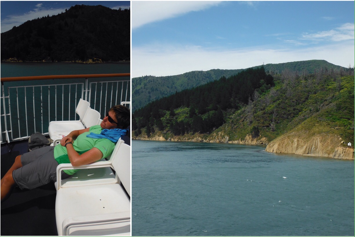
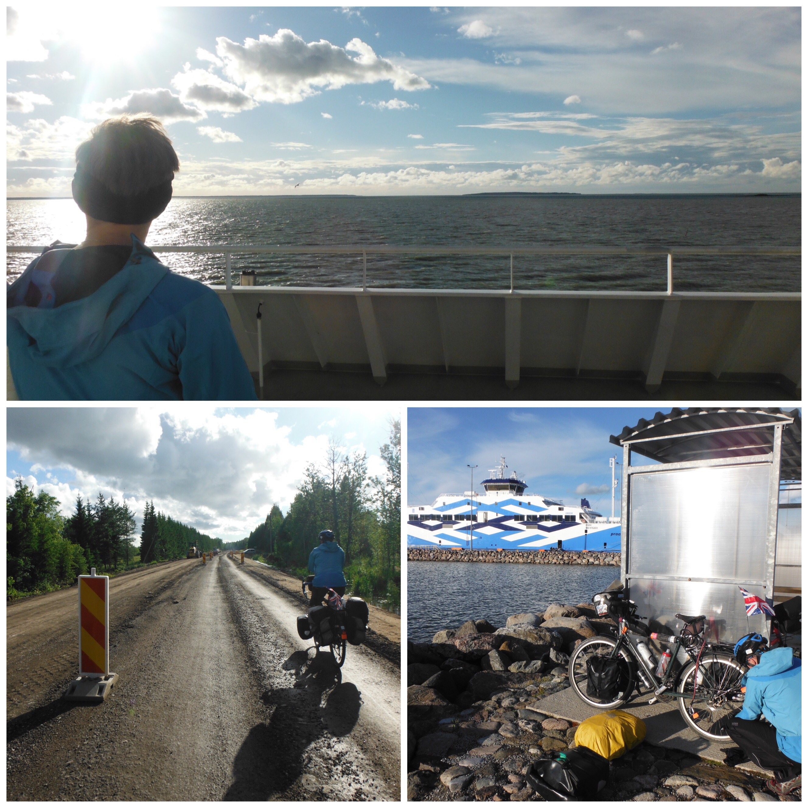
By evening things had calmed down. We were heading for the islands off Estonia’s west coast, as recommended by a Swiss couple in a camper van who made me a lovely cup of coffee in a campsite in Latvia. The ferry trip was smooth and sunny, it was like a different world. Jo continued to get some come-uppance for telling everyone about how few punctures she has had, with another as we rode off the ferry. It was getting pretty late by this point but as we were now further North it didn’t really get dark  so she managed a quick roadside change and we enjoyed another good campsite on Muhu Island.

The sun came out, the roadworks went on forever, Jo got a puncture.

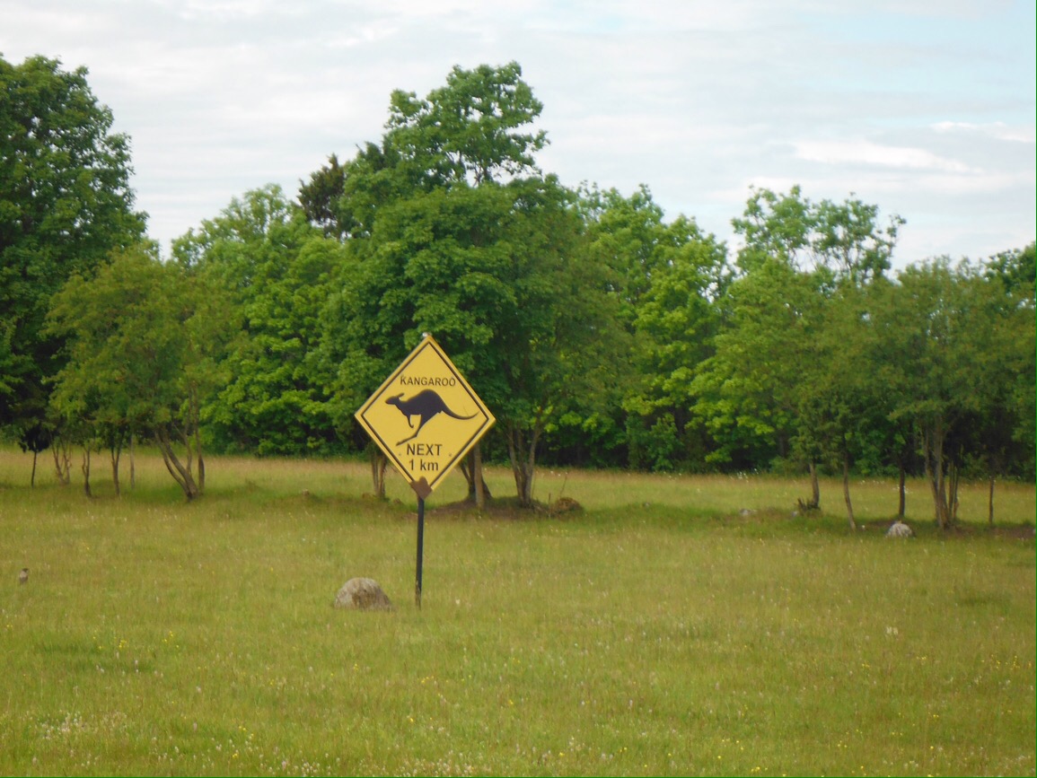
The plan for the next day was a 45km ish ride, a ferry to another island, then another 45km ish towards the next ferry for the following day. There were only three ferries per day, so if we missed the 1pm it would be a seven hour wait for the next one. I’m sure you can see what’s coming here. Obviously we left the campsite a little bit later than intended. Then we got a bit distracted reading the history of a cool causeway bridge thing. And by some kangaroo signs. Then there was a cute town (with lovely toilets). Leaving town, Jo’s puncture bad luck continued. We executed an extremely slick tube change but by this time it was after 11am and the ferry was still 30km away. Cyclists will read this and think that’s not sure a tall order. On road bikes or even unloaded hybrids it wouldn’t be. However on hefty 45kg touring bikes when you don’t really know where you’re going it’s a bit of a challenge. Add a killer headwind (we had turned westwards) and we were not feeling super confident. We made a quick start after the repair, until a few minutes down the road I realised the sun was in the wrong place/we were going the wrong way. Minor setback – we had left town on the wrong road. U turn required. Still 30km away, the race was on.

Lies.

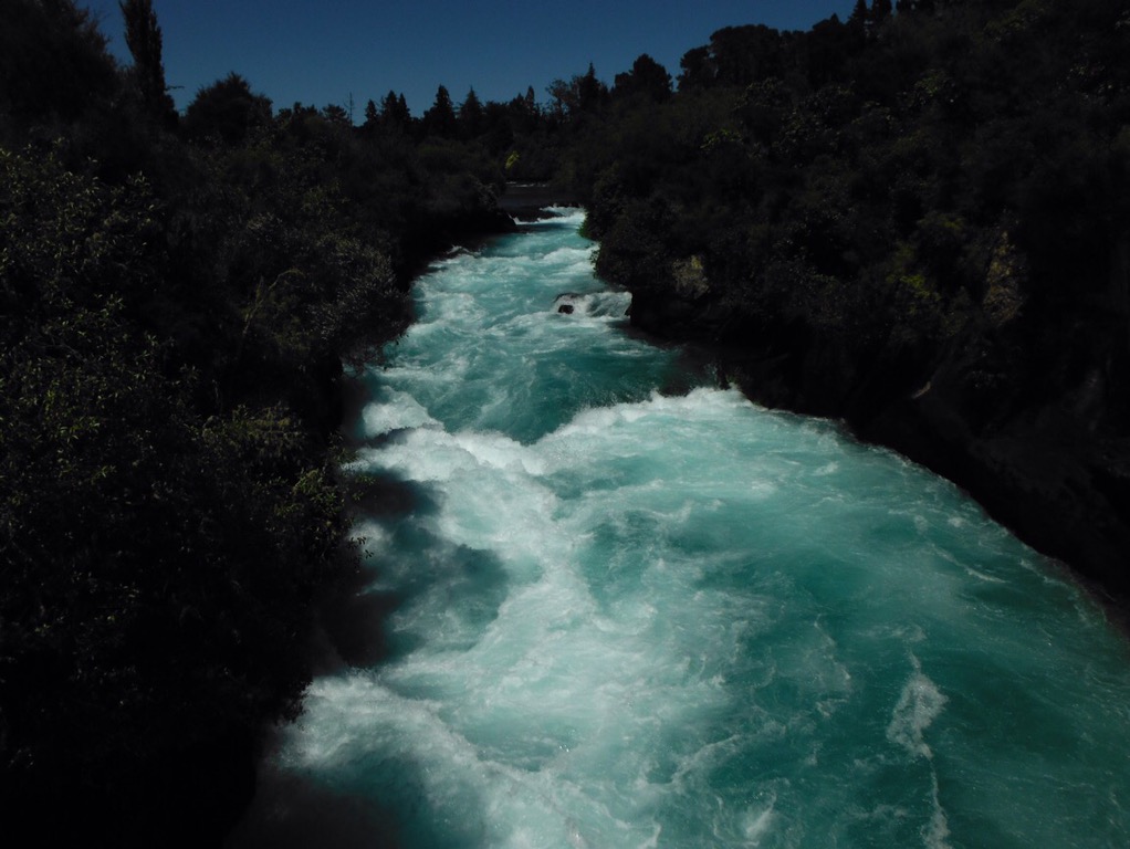
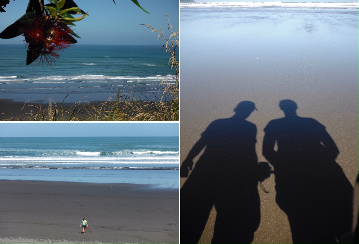
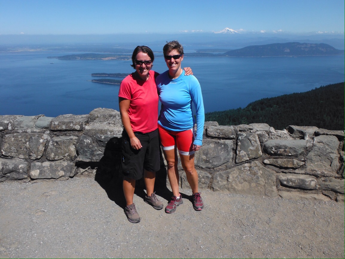
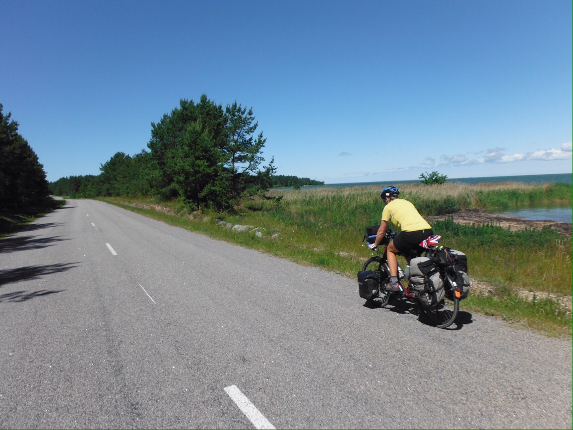
We pedalled hard, with just one emergency banana stop and made it with almost ten minutes to spare. It was a beautiful ride, and should you be in the area I would definitely recommend taking a trip to the islands. Quiet roads, loads of great campsites, lovely coastline.

Riding really fast. For us.

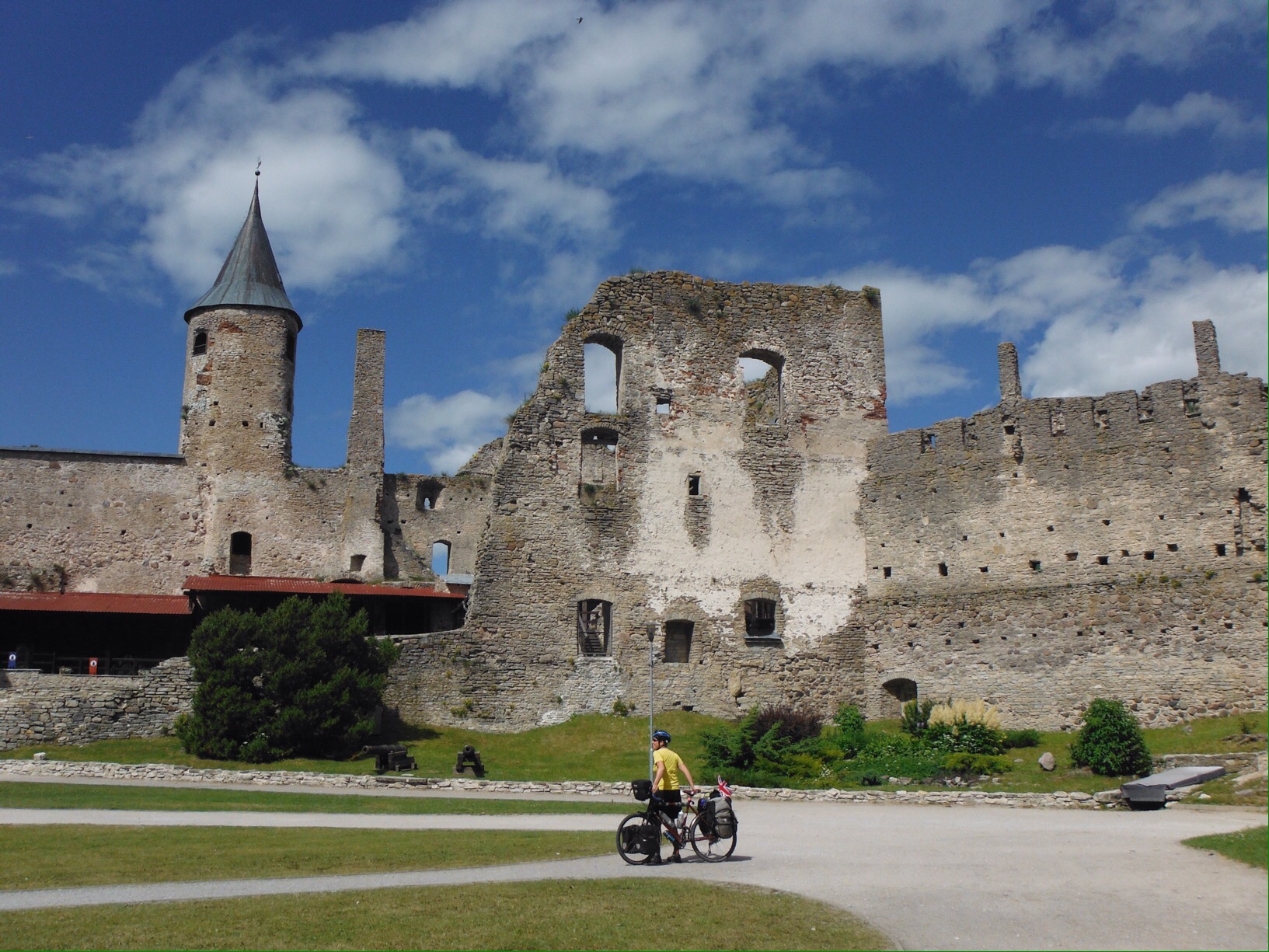
Back on the mainland, ruins were turning out to be another fun feature of Estonia. Most were signed from the road and had information boards with stories about the previous inhabitants. These seemed to have been written by members of the Soap Opera Writers of Historic Buildings Association, they were usually about controversial marriages, grand gestures of love, and murderous family members. Our favourite though was one that gave details of the St George’s Night Uprising of 1343. This described the killing of 28 monks and the burning down of a monastery as ‘only a minor setback.’ Seems like we should all reassess the barriers in our lives. Other than the odd buttress for safety the buildings had been left as they had been found, and were great to explore. The weather had cheered up and we were almost always on quiet roads. We were also meeting a lot of people doing cool trips – a German family with two toddler age children doing a three week camping tour, an Estonian family who moved to Austria for snow sports back visiting family, and in towns lots of retired Brits sailing around the Baltic (#newlifegoal – though I may need to improve on my RYA level 2). It was pretty dreamy cycle touring, and that was before we got to Tallinn.

Brill ruins
Chilling in the castle, Haapsalu

People ask us a lot ‘what’s been your favourite place?’ It’s an almost impossible question, as everywhere is so different, and fun/interesting/awe-inspiring in different ways. I can however quite easily pick out the cities that are worth going out of your way for (Rome, Granada, Tokyo); those that are good if you’re in the area (Riga, Bergamo, Seville, Malacca); and those that you could avoid and not feel like you’ve missed out (Napoli, many US cities, Vang Vieng, Siem Reap). Tallinn is definitely in the first group of awesome ones – there’s just so much to look at. Incredible old buildings, brilliant city walls, interesting food, and it’s a manageable size for walking. We had two days wandering around, helped on the second day by the lovely Toomas and Veronica, who we met in Laos some months earlier, and had recently returned to their home town. Go if you get the chance. If you don’t get the chance, go anyway.

Terrific Tallinn

We said goodbye to Estonia on a rainy Saturday morning, though it’s probably more of a ‘see you another time’, there’s a lot there still to see. Horizontal rain smashed into us as we cycled along the exposed ferry access road to board the ship to Helsinki. Once there we would be back on the route proper, finally turning back south west and towards the UK.
Thanks to: Toomas and Veronica, Anna, Federico.

Th-island hopping – cycles in SW Thailand

Another instantly different as you cross the border experience. On our ferry there was a monk and a ladyboy. On land, the forests looked wilder, not the regular rows of plantation palms we had seen for much of Malaysia. People no longer wore motorbike helmets or their jackets on backwards as they zoomed around on mopeds. There were A LOT of pictures of the King. The alphabet is crazy and we were not totally clear how much a baht was, but the road was good and Satun seemed a friendly town. Most importantly, we found a motel with cable TV, to watch the mighty Imps play Burnley in the FA Cup. 

Two of whatever’s in there please.

After a winning first dinner of pad Thai and banana rotis, we enjoyed watching the winning Imps and looking at some island options. Tiny Bulon Leh caught our eye, so we pedalled to Pak Bara for the ferry service. It was a scenic boat ride, with towering limestone stacks, blue sea and Bulon’s beautiful curve of white sand. Getting on to the beach was a little trickier. We had to transfer to a long tail boat (just like in every travel brochure picture of Thailand) to get from the speedboat to the sand. Getting the bikes off the long tail needed one person on the boat passing the bike to the other, stood in the sea, to carry above the water and up the beach. Two bikes and eight panniers took a few trips. 

Travel brochure Thailand I – arriving on Bulon Leh

We hadn’t booked any accommodation as we had heard that you could make a donation to the school and camp just back from the beach. This turned out to be true, so we put our tent in one of it’s best spots of the whole trip. There were a few downsides to camping, mainly the ants and the heat, but the location made up for the discomfort. White sand, turquoise water, blue sky – like an episode of Death in Paradise without the ‘impossible’ murder, only four suspects and Ardal O Hanlon. (That’s right, we are fully up to date on all the big changes back home). 

Bulon is a great size for exploring and I would recommend a visit if you are in the area. It’s small enough to walk all the ‘roads’ in a few hours, yet developed enough that there’s a good range of accommodation and choices for eating. We snorkelled, saw lots of fish, and circumnavigated the island by kayak, only getting a little bit seasick. We also enjoyed hanging out with Andrew and Marcy, two cyclists we first met on a train in Kuala Lumpur. (They are on instagram @convenientlylocated where you can see some much better photos of some places we’ve been and lots more that we haven’t). Apart from the sweaty sleeping arrangements, it was like a real holiday.

island mini break
Travel Brochure Thailand Ii – one of the Trang Islands on our speedboat ride

It was tough to leave but the speedboat ride to Koh Lanta helped. Massive chunks of rock sticking out the the sea, dreamy islands and beaches, finally mangroves and precariously built restaurants as we approached the port. There were no cars on Bulon, only the odd motorbike and a few handfuls of people around, so it had been a very quiet island getaway. Arriving on Koh Lanta was the exact opposite. We had to transfer the bikes and bags to the main jetty via two other boats. Once on firm ground there were hundreds of people in vague queues with either extremely large backpacks or wheely suitcases. The wheely suitcase crowd seemed averse to rolling their suitcases for our ease of passage. Or perhaps we just make lifting 45kg bikes around them look so easy it appears there’s no need. We eventually emerged into taxi driver alley. They all thought they were the first to make the same joke. Point at bikes, say ‘Taxi?!’ Laugh. At least it wasn’t ‘How do you cross the ocean?’
Super cycling Krabi to Phangnga. Tiny cyclist in view

We escaped the port town and found a nice beach further south for dinner and sleeping. It was much busier here but brill to have a shower that wasn’t the sea and a room with fan still in earshot of the waves. Refreshed, we spent four days riding to our next island mini-break, via Krabi, Phang-nga, Khao Lak and Khuraburi. On the way there were some great little roads between limestone cliffs, villages with friendly people who thought we were nuts, mosques, temples, giant buddhas and all manner of other stuff to look at. We stopped regularly for fruit or iced tea or rice and vegetables. It was very hot. There was a bit of drag of touristic development along the Khao Lak coast. Imagine Skegness with tailored suits and massage instead of slot machines and chips. And a much better beach. We weren’t sure where to stay, and ended up at a bar with camping on the most scenic of the beaches. The downside was the ominously grey sky and thunder out at sea. The evening improved when my coconut shake arrived in a coconut. It then got even better when the bar staff said we could sleep on the massage platform so we didn’t have to put the tent up in the rain. We fell asleep to the sound of waves on what was essentially a school gym mat. 

Lightning from the beach at Khao Lak

In Khuraburi we spent some time finding out how to get the boat Phra Tong, our next island. Excitingly, we would see someone we knew there, a good friend from university on her own Asia adventure. We were given some detailed directions and a hand drawn map. 

“Turn right at the 7-11 (there were three), go past the school, 12km, turn right at the…Muslim?”

“Mosque?”

“Yes, for Muslims, 200m, ferry. Get there early, 9am. Sometimes if no water, 11am. Be early.”

We took the advice and rode early. At 8:15am there were two English cyclists and a small crowd of fisherman at the… port? Boat area? There wasn’t any water though, and the boat would clearly not be going at 9am. Jo went back up towards the Mosque to find some second breakfast. The water started rising, and some little fishing boats paddled in, adding to the crew hanging out drinking tea. A larger boat arrived, we established that this was our boat and keenly lifted the bikes on. A truck arrived with what seemed like a year’s supply of juice cartons in. These were also going to the island. Eagerly, we helped with these, thinking that once the loading was complete we would set off. In fact, once the boxes were on, the captain told the three Thai women waiting we would leave at 12 or 13. It was 9:55. Another couple who were waiting got on the boat ready. We retired to some shade, but didn’t leave the area completely as we didn’t trust the ’12 or 13.’
Our captain wandered around for a while, checking out a boat that was being built nearby, getting a snack, chatting to some fishermen. We wrote our diary, read some of our book, wondered about another trip to the breakfast place. All of a sudden, at 11:15, he pointed at us and the boat. It was time. Unlucky the three ladies who were coming back for twelve.

No departure boards here

We toured through mangroves and saw monkeys swinging around. On Phra Tong there didn’t seem to be a great deal. We found the road from the jetty village, not so tricky as it’s the only one on the island. It is concrete and just the width of a pick up. More mangroves, more monkeys. We rode for about 45 mins and saw one lady on a moped. There were no signs anywhere, our offline map helped us to identify that a sandy side track should take us to an area with a couple of accommodation options. We selected Mr Choi’s. He is quite the character should you be passing. Our bungalow was on stilts, the floor made of thin boards with big gaps between. Great for air circulation, rubbish if you drop something. Or several things.


It was weird but awesome to walk down to the beach and find someone we knew. This was one of the least easily accessible places we have been on the trip, there was hardly anyone else there, yet one of them was someone we had known for many years. As with the rest of the country the tap water is not drinkable but 4g and wifi was excellent despite the sparsity of population. We spent four days walking the long, empty beaches, kayaking to other small islands, eating pineapple fried rice out of a pineapple, and laying in hammocks reading. Now this was a holiday. Even on the last night, when there was no electricity to our row of bungalows (usually running 6-11pm) because as Mr Choi explained, the generator was “kaput” and he had to choose between keeping the electricity for our row or the row with a family and baby in and “I choose baby of course”. The next morning we joined the kaput generator on Mr Choi’s boat for a private ride back to the mainland, to the real marina this time with other boats and everything. If the dream of an unbroken cycle to China by 2nd May (last entry date for our visa) was still on, it was time to stop lazing in hammocks and start pushing the pedals round. Fast.


An extra four wheels

To get back to Auckland in time to celebrate Christmas with our NZ famil-Lee we had to find an alternative to cycling. Flying was an unattractive prospect and buses are still not on a full schedule after the Kaikoura earthquake so we investigated how an extra four wheels might help us. Most people who rent cars and campervans here pick up in Auckland and drive somewhere in the South Island to fly home. So luckily for us, rental companies need these vehicles driving back up north and offer nice perks to counteract the fact that they need them back as quickly as possible. We managed to book a small self-contained camper for free, as long as we took no more than four days to get from Christchurch to Auckland (1300kms). All we had to pay for was one passenger on the ferry, and the petrol. Deal.

First of all we had a day to look around Christchurch. The city is still in recovery after the major 2011 earthquake that killed 185 people and destroyed most of the CBD. Since the last time we were here (2012) it looked like the city is progressing well – piles of rubble have been cleared, empty lots have been tidied up and there are a number of new flash buildings. In 2012 the re:start shopping mall in bright shipping containers just had a handful of shops; now it is a thriving shopping space with cafes, street performers and food. It was very busy. We liked Christchurch a lot. It seems like there is plenty going on, the regeneration is an exciting time, it’s a manageable sized city and there’s even decent cycling infrastructure.

Clockwise from top left: Big chairs in the CBS; 185 white chairs, one for every life lost in the 2011 earthquake; re:start shipping container mall; damaged cathedral; interior of the new temporary “cardboard cathedral”

But we had Christmas in Auckland to get to. After not driving for well over a year we were a little apprehensive about getting behind the steering wheel. How would it feel to be travelling so fast? We had other things to think about too. How much does petrol cost these days? How often will we need to fill up? What’s the speed limit? Where will we park? How close can we get with the car? All things we haven’t had to consider in a long while. Especially not the speed limit.

Kitchen; bedroom/bike storage

The camper itself was well thought out, with a small kitchen area at the back and a fold up bed/table in the main area. It came with everything you might need – all cooking stuff, real mugs, chairs and table to sit outside, gps, chargers, there was even the luxury of huge pillows and a duvet. Debs was excited to find a coffee plunger; I was more excited about a plug in tourist gps radio (that turned out to be dull). After listening to our iPod through its own speakers for months we could plug it in to the car stereo. We even had two big fluffy towels each. Not that we planned on showering, but nice to have them just in case. It also had a porta potty and a way to store waste so we had that all important “self-contained” sticker on the back. These are highly sought after as new freedom camping rules means that there are loads of designated free camping sites, but only if you have the magic sticker (so you won’t go in the bushes in the night). We were now one of those people who we were jealous of when looking for a free spot to pitch our tent and finding “self-contained only” signs. Life was good. It was luxurious even.

Squeezing the bikes in around all of these luxury items was a bit tricky but by taking the front wheels off they stood between the bed and the front seats. Driving out of Christchurch was easy, it’s hardly a big city, and we had the pleasure of going to a supermarket knowing we could buy what we needed for the next few days all in one go. No need to worry about the weight. We bought an extra couple of tins of beans ‘just in case’. There was even a cool box so we could have real milk in our tea rather than powdered. These are the type of things we can usually only dream of.

As the road through Kaikoura (the shortest way to ferry to the north island) is closed following a landslide after the most recent earthquake, we had a seven hour drive ahead of us to get to Picton. Excitedly we hit the open road, marvelling at how fast we were travelling, how we couldn’t even tell the road was going up (we had a pass to get over), and having nothing much to think about other than which album to have on next. The novelty lasted a couple of hours. That was all it took to realise how much we loved cycling.

It was boring, particularly being the passenger. I think I fell asleep for a while. (While Debs was driving of course.) Everything went by so fast, it was hypnotising. On the bike you can stop and take a picture whenever you like. In the van it was more “that’s a good view can we… oh it’s passed now. Never mind”. We were up the pass and over the other side in no time, and I felt like we hadn’t really had time to look properly at the scenery. Both of us had to really concentrate when driving to make sure we didn’t gaze around, something you do without thinking on the bike. It was uncomfortable sitting still in the same place for so long, and there weren’t many places to stop and stretch your legs. But mostly we felt lazy. We had become so accustomed to the feeling of satisfaction gained from making distance purely through physical activity. It was strange because we expected to enjoy being able to travel so effortlessly, but it just felt wrong somehow. It also meant we couldn’t stop and eat every ten minutes like we usually do. That’s not to say we weren’t pleased to be in the van when it rained for the last few hours to Picton.

Driving up towards Lewis Pass

It was pretty late when we arrived at a good free camp spot by the beach. Dreams of just being able to park up, get in the back and go to sleep within the space of a few minutes didn’t quite work out as we first had to manoeuvre the bikes out and lock them outside, but it was still a much faster process than tenting. We woke to an amazing sunrise over the river and cooked up a porridge breakfast that we could sit on chairs with backs to eat. Whilst the actual travelling wasn’t as fun, the process of camping was made a lot easier with the van.

A three hour scenic ferry ride got us to the North Island and we had another mammoth drive to make sure we could meet up with friends from the UK the next day.

Ferry ride across the Cook Straits

That night we slept by the side of the Desert Road at its highest point (over 1000m) on the edge of Tongariro National Park, in the shadow of Mt Ruapehu. Mt Ngauruhoe (Mt Doom to LOTR fans) was also in view. Cooking rice and tuna as the sun set behind the mountains was pretty special, even if we hadn’t pedalled ourselves there. The next morning the sky was clear and the views even better. It was pretty cold up at that height so we welcomed the duvet.

Sunset over Mt Ruapehu
Sunrise at Mt Ngauruhoe (Mt Doom on Lord of the Rings)
Not a bad view to wake up to (and look at from a chair with a back)

After a second breakfast on the shore of Lake Taupo we drive round to Huka Falls to meet friends for a walk and a soak in the natural hot pools. After not seeing anyone from home since April this was amazing!

Huka Falls
Soaking in the natural spa pools

Time went too fast and we had to hit the road again. Searching for our first west coast sunset in New Zealand we drove north via Raglan, a west coast surf town with some great beaches. The sun set over the sea, we again cooked with an amazing view and the next morning we even had time for a couple of hours on the beach before dropping the van off and getting back on the bikes. A ride, train, ferry and final ride got us back to the North Shore.

Sunset over the Raglan surf beaches
Dinner
Morning beach walk, Raglan

Overall it was a fun way to do the journey we had to do in the time available. Much better than flying. Being able to camp anywhere was nice, and we had three great camp spots. But as a way to travel, cycling still wins. By far. On a bike you experience everything that is around you, so intensely. The weather, the temperature, the wind, sounds, animals, traffic, road surface, you feel every little thing. Being in a vehicle neutralises this. It could be boiling hot or freezing cold outside – we were a constant temperature. The road could go up or down – it felt the same to us. The wind could be roaring, the trees blowing or the streams gushing – all we could hear was the engine and the stereo. We just felt so detached from the environment we were travelling through. Want an adventure? Get a bike! [disclaimer: it is very tiring cycling everywhere.]
Thanks to Gen & Nick (again); Viv & George (again); Hels & Gaby for the English company.

Cycling Shikoku saved us from scurvy

It was dark by the time the ferry docked at Takamatsu. We had identified a sports centre campground about 10K out of town, so after a supermarket sushi stop we rode south and uphill towards it. Arriving at the sports complex was just that. There were lots of little roads, unhelpful staircases and we couldn’t see the symbols for camping anywhere. Jo went into a building that looked a bit like a conference centre to ask. Weirdly, she could get into the building but not out. I had to get the automatic doors to open from outside. With directions from the staff, we found the camping area – closed due to wild boars. Lots of warning signs. Hmmm. As it was now 9pm we didn’t fancy riding much further, so went back to the facility to ask for more help. Turns out it was an old people’s home. Jo got stuck inside again, this time with no helpful information. We found a bit of grass next to an astroturf pitch and hoped the wild boar didn’t fancy a midnight kick about. This started a Shikoku trend of campsites that were either brilliant or bizarre. Top ones included a beach side spot under a handy shelter, and on the scenic Shimanto riverside. The real low was on some deeply furrowed ground at the side of a forestry building in a small village. Very bumpy.

Route 32. Flat-ish for a while

It was great cycling south along route 32, finally we had found a road that was flat-ish and not super busy. It was along a scenic river gorge, had some fun tunnels and some great fake construction men. We also had our second Japanese Police encounter. A kind man stopped, showed us his badge, gave us a whopping bag of mandarins, told us to call the police if we had any problems (possibly, it was in Japanese but I got the numbers) and drove off. We had just bought a bag of mandarins so the food pannier became a little unwieldy. They had just come into season and had become Japan’s only affordable produce item. There are some seriously pricey nashi pears around should you be considering a fruit based investment any time soon. Even better, next time you are mentally planning what to do with your lottery winnings, buy an orchard in Japan.

Well-looked after fruit in Japan comes with a hefty price tag

The cycling went figuratively downhill but actually uphill when we turned off to visit a bridge made from vines in a neighbouring valley. We saw a little road barrier up above us, virtually in cloud, and thought, ‘wow, you couldn’t get up there in 6km, that can’t be our road.’ Apparently you could, and it was. We cursed our choice, especially knowing that we would have to do the climb in reverse the next day. Even better, the next day it rained like the sky was falling in. Luckily the vine bridge was very cool indeed.

Amazing vine bridge.

It was great to see the sea and the sunshine after we left Kochi on the Saturday morning. The road followed the south coast for a good stretch and we passed lots of pilgrims in hats and white shirts walking the 88 temples route. We turned further inland on route 81, followed the Shimanto river and supplemented our mandarin intake with local kaki. Shikoku was definitely the best cycling of our time in Japan, even before we found out about hat cakes. The road along the west coast was right along the sea, great views, occasional beaches and even more mandarins and kakis. This time free from some kind ladies in a bakery that filled our water bottles too. We also had another fun ‘onsen before bed’ camping night. Though I think some of the onsen-induced relaxation may have been lost as we had to put up the tent in rain and high winds in the dark after our soothing soak. Jo was particularly proud of her tarp-windbreak construction.

The 88 temple trail is a popular long distance hiking route
Great breakfast spot after an uncomfortable sleep on bumps.
Lots of little harbours and fishing villages.
Jo's excellent engineering
Jo’s excellent engineering

Arriving by ferry to Kyushu, we decided to have a rest afternoon and more onsen time in Beppu. It’s possible we didn’t see it’s best areas, as Beppu appeared to be a bit like a Japanese Skegness with more sleaze and hot springs, and less stag dos and candyfloss. It was the ugliest town we had seen (there had been a few unpretty ones) and the only town we visited in Japan where it seemed like there might be somewhere you shouldn’t walk at night. The old onsen building made up for it – a historic wooden and stone building with very hot baths for one US dollar. Brilliant. Beppu really made itself unforgettable when our sushi arrived on a mini bullet train later that evening. I cannot imagine why this travel experience is not listed in any information I have read about Japan.

Loved it.
Loved it.

Running out of time, we took the most direct route to Fukuoka and it wasn’t super fun. If you find yourself cycling in Kyushu, leave more time and go a different way to us. The highlight of the trip was finding egg and rice vending machines with a pleasant rest area at the roadside. As I’ve since learned there’s an egg vending machine in Sileby, Leicestershire, probably go for the mini-train Sushi when you are planning your own trip. When we spoke to locals in the Tokyo and Fuji area at the start of our Japan cycle, their reaction to us cycling to Fukuoka was usually ‘This is not possible,’ accompanied by headshakes, crazy foreigner expressions etc. They were nearly proved right, when on the last day we saw some mile markers counting down to something. It turned out they were counting down to the point the road became a motorway and bikes were not allowed. Cue steep and long detour on much smaller road. As I said, go a different way to us.

Japan is a fantastic country to visit. Cycling on Honshu and along our Kyushu route is not for the faint hearted as the more built up areas can be very busy. Having said that, car drivers were almost always patient and considerate when passing us. Shikoku was by far the most enjoyable cycling of our trip.

Fab cycling on Shikoku
Riding right along the sea

Navigating Japan wasn’t too tricky – we didn’t buy the maps that most cycling websites recommend and just used our offline map to find ourselves in cities sometimes. There were times when we had to look for the Kanji for a town name as English wasn’t on the signs, this was more tricky. The only symbols I would be confident to recognise only a few weeks later are the five that make up ‘campground’ and the one for ‘western’ toilet (as opposed to squat). I wish we had learned more Japanese to speak to people though we always managed to achieve what we needed with some prepared phrases, gesturing etc. People were friendly and kind, even when they clearly thought we were deranged for cycling so far with loads of stuff. Just like people we have met in Italy, Croatia, USA and everywhere else.

Japan wasn’t part of the original trip plan, but I’m really pleased we took the opportunity to visit this truly unique place. Great scenery, awesome food, and a good sprinkling of crazy stuff.

A fair sprinkling of crazy stuff. More than one gas station had their own T Rex.

Pacific Island Hopping (kind of)

How to cycle across America in 3 easy steps:
1. Choose start point

2. Choose end point

3. Ride bike between the two.

Sounds easy. It is really. We love riding our bikes, and this trip is just going for a bike ride somewhere new every day. What’s not to love? If you keep going in the same direction, and do it for a long time, you can get quite far. Across a continent even.

Our flags were starting to look as tired as our bodies felt

But we made quite a basic mistake. In our eagerness to ride, we skipped step 2 and rushed ahead with step 3. Our end point was always “somewhere on the Washington coast”; as we got nearer it became defined as the small port town of Anacortes where we would celebrate with a beer before catching a ferry to explore the San Juan Islands at a slow pace for a few days. Great plan. However we looked at a map and realised that Anacortes is not west facing, so it not at “the end”. This would not do. It is however situated on a peninsula with a west-facing coast, so that was our vague end point. But even that didn’t quite go to plan.

We only had 20 miles to ride on our final day, leaving plenty of time to find a decent spot, dip the wheels in the Pacific Ocean (we had a ceremonial wheel dipping in the Atlantic in Boston) and maybe even spend the afternoon relaxing. After the hard ride across Washington we were very excited about this plan. We looked at the map, and realised we could ride a slightly longer route via Deception Pass, a famous high bridge with decent views out to the ocean. This might even fit our requirements for a West facing end point. With only 20 miles to Anacortes, what would be the harm of a little tourist detour? We had all day after all. So after a long leisurely breakfast in Burlington we rode the flat route towards Anacortes and then turned off towards Deception Pass. Uphill. On a fairly narrow, busy road. Sweating and questioning our judgement we climbed and dropped, stopped to buy a 6-pack of beer, climbed and dropped some more and arrived at Deception Pass only to find it completely covered in fog. We couldn’t see an amazing view; we could hardly even see the sea. This would not do as the finish point. So we ate a quick lunch and rode on.

The road on the West of the peninsula looked to be right along the sea, but as with many places in North America a strip of private land with waterfront properties kept us away from the edge. There was a beach marked on the map – we aimed for that only to find that was private too. The road was steep and hilly, it was boiling hot and the day was slipping away from us along with our dreams of having a few hours to relax with a cold drink. Finally we came across a vacant lot with a ramp down to the water, facing out to the ocean. Not ideal but we could touch the water with the bikes. So we wheeled them down the ramp and got our coveted picture, almost losing the heavy loaded bikes to the ocean. But we had made it. The end of almost 5000 miles across the USA was a steep concrete ramp on an empty scrub of land that we had to climb under a very heavy chain to get to. This was not quite how the “end” had been played out in my head over the past week. And as we were trespassing we thought this probably wasn’t the ideal place to sit, so we hauled the bikes back up the ramp, over the vacant lot, under the heavy chain and back to the hilly road until we found a place high up where we could sit and see the ocean and drink our beer. It was almost 5pm. Not much time for contemplation or reflection. We had cycled across the huge continent that is North America. How did it feel? Just the same as any other day.

We were lucky to be staying in Anacortes with a wonderful family who helped us celebrate with a big dinner and berry dessert – we had been picking roadside blackberries. The next day we caught a ferry to Shaw Island, the smallest of the four San Juan Islands that can be reached by public ferry. The island has a permanent population of about 200, has no town, just a country park and a small grocery store at the ferry dock. There are no printed maps, just a hand-drawn one at the port. The beachside campground with only 11 sites seemed like the perfect place to set up camp for a few relaxing days.

Clockwise from top right: Riding on San Juan Island; relaxing island style; the map of Shaw Island at the port; picking berries; enjoying the ferry (ice cream and a jigsaw, perfect…); deer by the camoground; riding on Shaw; the ferry ride

A great thing about the islands is that once you have paid to get there from Anacortes, the inter-island ferry is free for foot passengers (and bicycles) so once you are there you can ferry to the other islands as much as you like for free. So we did. The first day all we did was take the ferry to San Juan Island, the biggest of the group, eat fish and chips and ice cream (separately), then take the ferry back. On the second day we stretched ourself a bit more and took our bikes to Orcas Island, the hilliest one, and rode up to the highest point on the islands. This was a 40 mile round trip with 5 miles steep uphill to the summit of Mount Constitution at 2400 feet. It was 8-10% grade for most of the climb, which our unloaded bikes managed without a problem. From the top the view was spectacular over the islands, and in the distance you could see the snow-covered Mount Baker back over the border in Washington.

Our campground was small and quiet, and right by the beach. As with most North American campsites, it was full of people who take camp cooking very seriously. One night we were treated to paella cooked in a proper paella pan, followed by individual chocolate puddings cooked on the campfire in a Dutch oven. It doesn’t take much to beat our pasta dishes but this was some serious camp cooking, and we enjoyed testing the results.

After four days it was time to head to Vancouver, a couple of days ride north. Here we planned to have a proper holiday, and hang out with people we knew for the first time in months. As we crossed the Canadian border and arrived at The Best Place On Earth (British Columbia is very nice, but that’s quite a claim), it felt maybe like this was the end of our coast to coast trip – a familiar place where we were going to see familiar people. Welcome to Vancouver!

Thanks to Pat and Don; Jude, Carrie and the rest of Team Apple; John and Bill for so,e company on the islands; the Seattle campers for the paella and Dutch oven cooked goodies; Reid, Erin and family.