Pacific Island Hopping (kind of)

How to cycle across America in 3 easy steps:
1. Choose start point

2. Choose end point

3. Ride bike between the two.

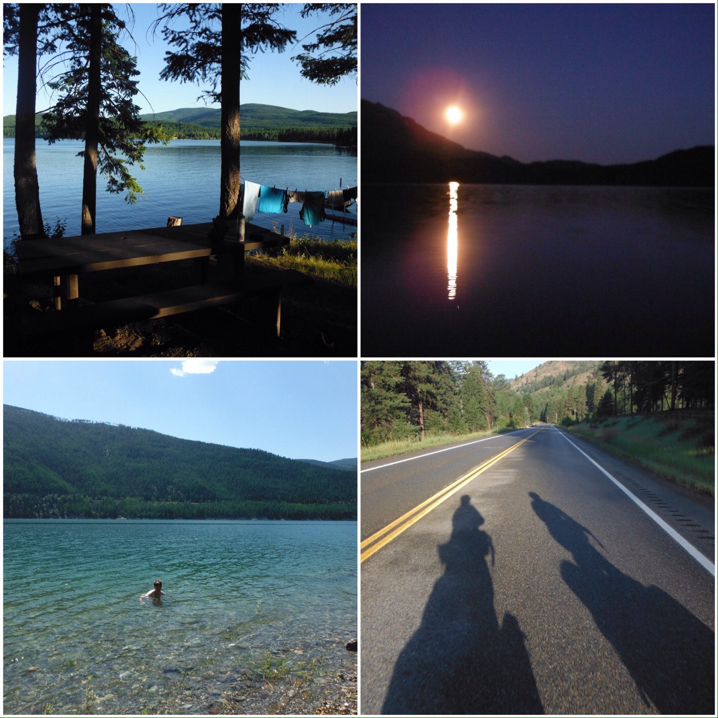
Sounds easy. It is really. We love riding our bikes, and this trip is just going for a bike ride somewhere new every day. What’s not to love? If you keep going in the same direction, and do it for a long time, you can get quite far. Across a continent even.

Our flags were starting to look as tired as our bodies felt

But we made quite a basic mistake. In our eagerness to ride, we skipped step 2 and rushed ahead with step 3. Our end point was always “somewhere on the Washington coast”; as we got nearer it became defined as the small port town of Anacortes where we would celebrate with a beer before catching a ferry to explore the San Juan Islands at a slow pace for a few days. Great plan. However we looked at a map and realised that Anacortes is not west facing, so it not at “the end”. This would not do. It is however situated on a peninsula with a west-facing coast, so that was our vague end point. But even that didn’t quite go to plan.

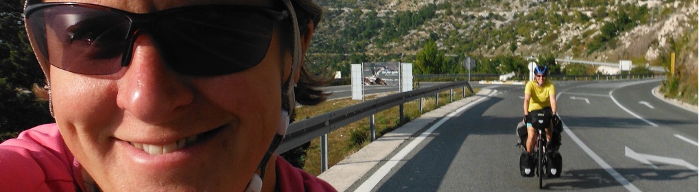
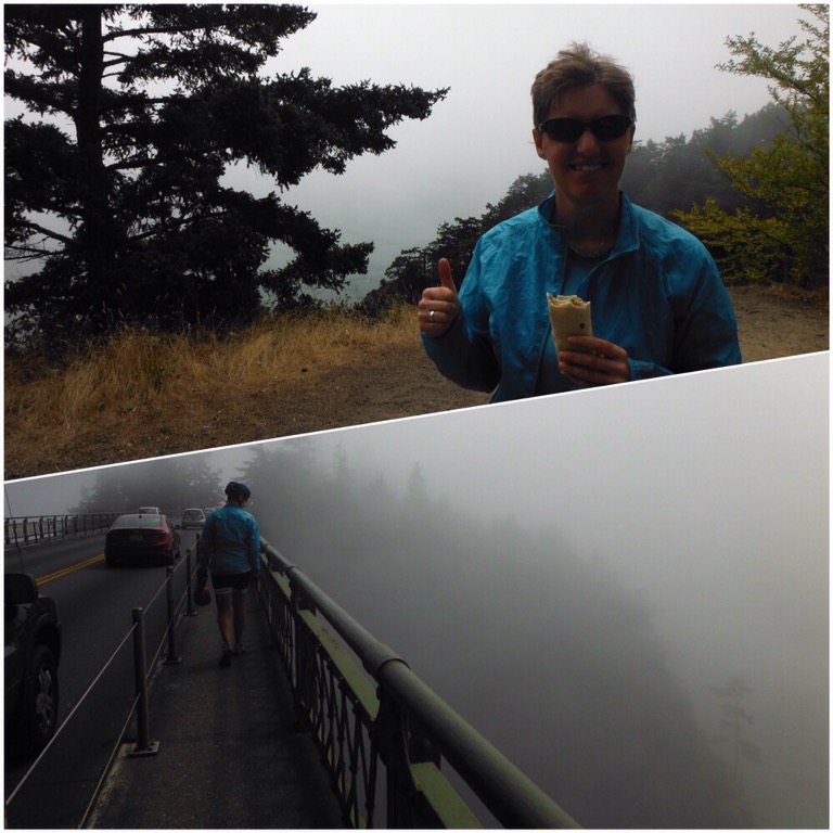
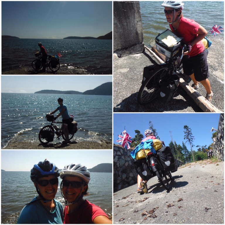
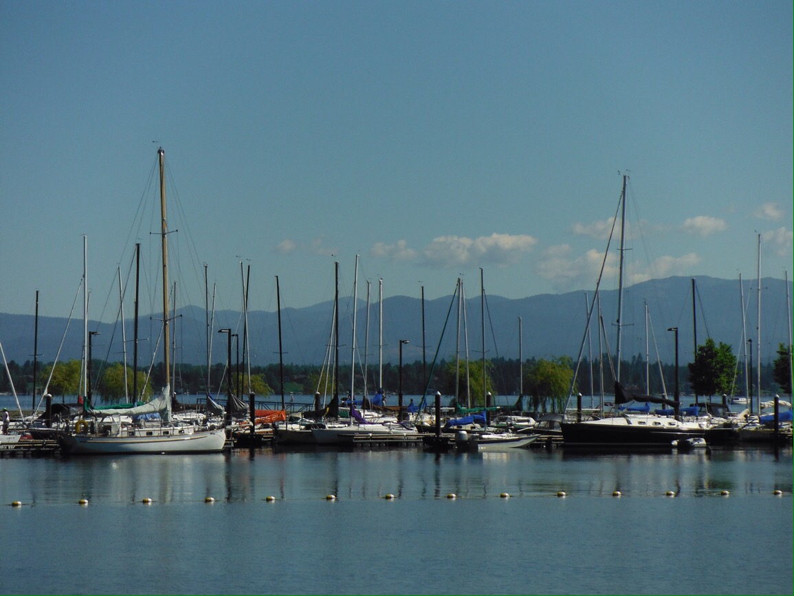
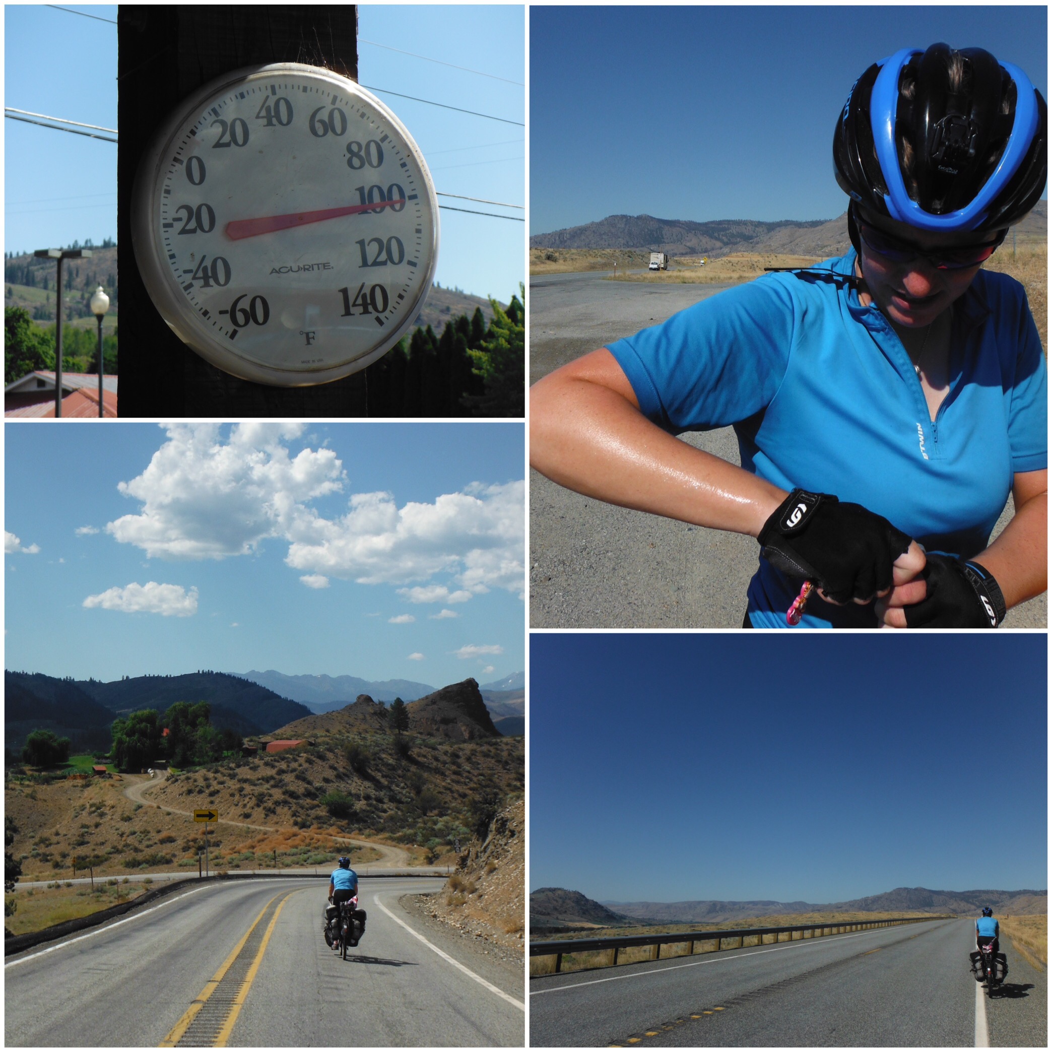
We only had 20 miles to ride on our final day, leaving plenty of time to find a decent spot, dip the wheels in the Pacific Ocean (we had a ceremonial wheel dipping in the Atlantic in Boston) and maybe even spend the afternoon relaxing. After the hard ride across Washington we were very excited about this plan. We looked at the map, and realised we could ride a slightly longer route via Deception Pass, a famous high bridge with decent views out to the ocean. This might even fit our requirements for a West facing end point. With only 20 miles to Anacortes, what would be the harm of a little tourist detour? We had all day after all. So after a long leisurely breakfast in Burlington we rode the flat route towards Anacortes and then turned off towards Deception Pass. Uphill. On a fairly narrow, busy road. Sweating and questioning our judgement we climbed and dropped, stopped to buy a 6-pack of beer, climbed and dropped some more and arrived at Deception Pass only to find it completely covered in fog. We couldn’t see an amazing view; we could hardly even see the sea. This would not do as the finish point. So we ate a quick lunch and rode on.

The road on the West of the peninsula looked to be right along the sea, but as with many places in North America a strip of private land with waterfront properties kept us away from the edge. There was a beach marked on the map – we aimed for that only to find that was private too. The road was steep and hilly, it was boiling hot and the day was slipping away from us along with our dreams of having a few hours to relax with a cold drink. Finally we came across a vacant lot with a ramp down to the water, facing out to the ocean. Not ideal but we could touch the water with the bikes. So we wheeled them down the ramp and got our coveted picture, almost losing the heavy loaded bikes to the ocean. But we had made it. The end of almost 5000 miles across the USA was a steep concrete ramp on an empty scrub of land that we had to climb under a very heavy chain to get to. This was not quite how the “end” had been played out in my head over the past week. And as we were trespassing we thought this probably wasn’t the ideal place to sit, so we hauled the bikes back up the ramp, over the vacant lot, under the heavy chain and back to the hilly road until we found a place high up where we could sit and see the ocean and drink our beer. It was almost 5pm. Not much time for contemplation or reflection. We had cycled across the huge continent that is North America. How did it feel? Just the same as any other day.

We were lucky to be staying in Anacortes with a wonderful family who helped us celebrate with a big dinner and berry dessert – we had been picking roadside blackberries. The next day we caught a ferry to Shaw Island, the smallest of the four San Juan Islands that can be reached by public ferry. The island has a permanent population of about 200, has no town, just a country park and a small grocery store at the ferry dock. There are no printed maps, just a hand-drawn one at the port. The beachside campground with only 11 sites seemed like the perfect place to set up camp for a few relaxing days.

Clockwise from top right: Riding on San Juan Island; relaxing island style; the map of Shaw Island at the port; picking berries; enjoying the ferry (ice cream and a jigsaw, perfect…); deer by the camoground; riding on Shaw; the ferry ride

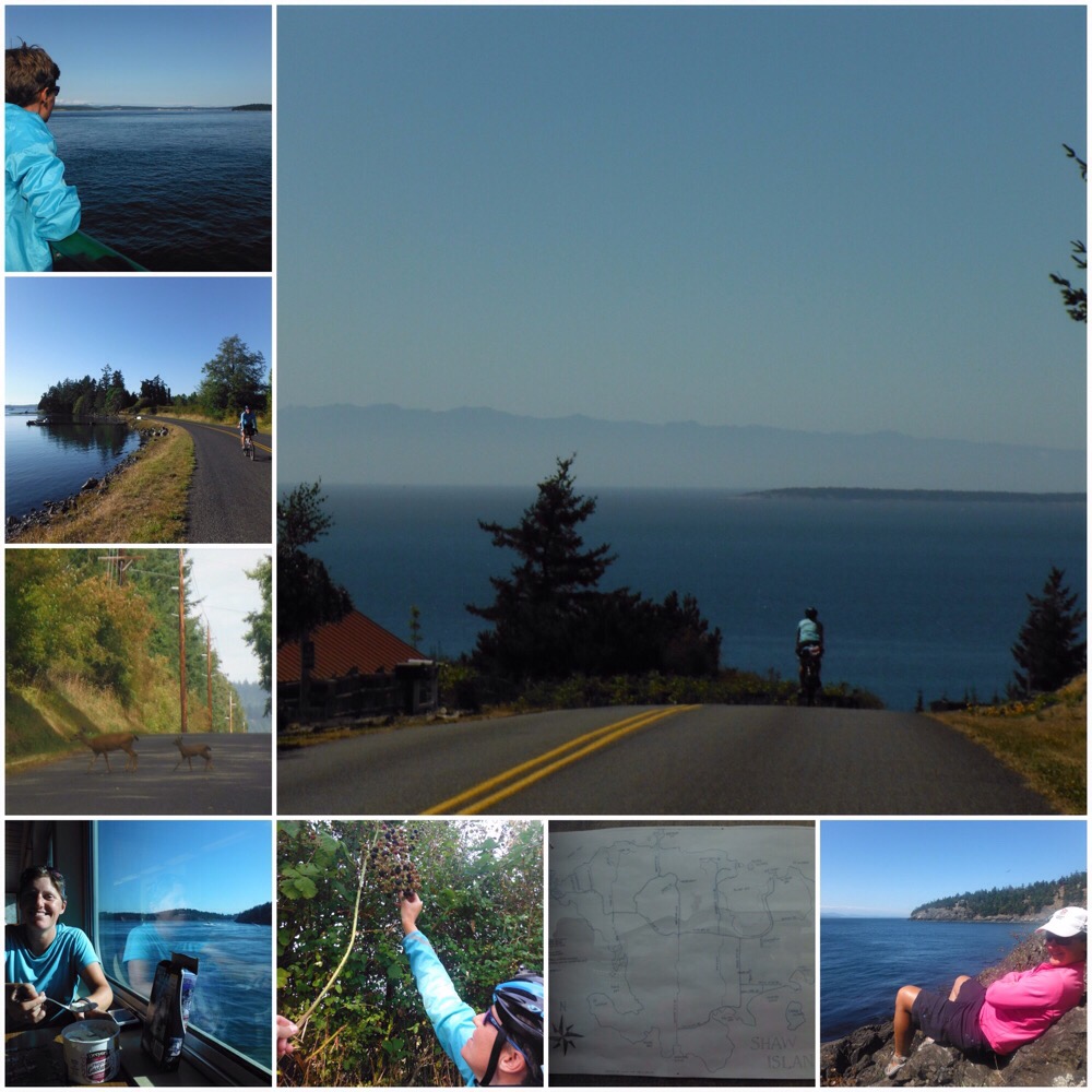
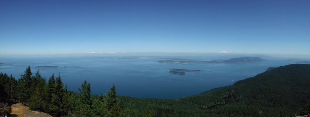
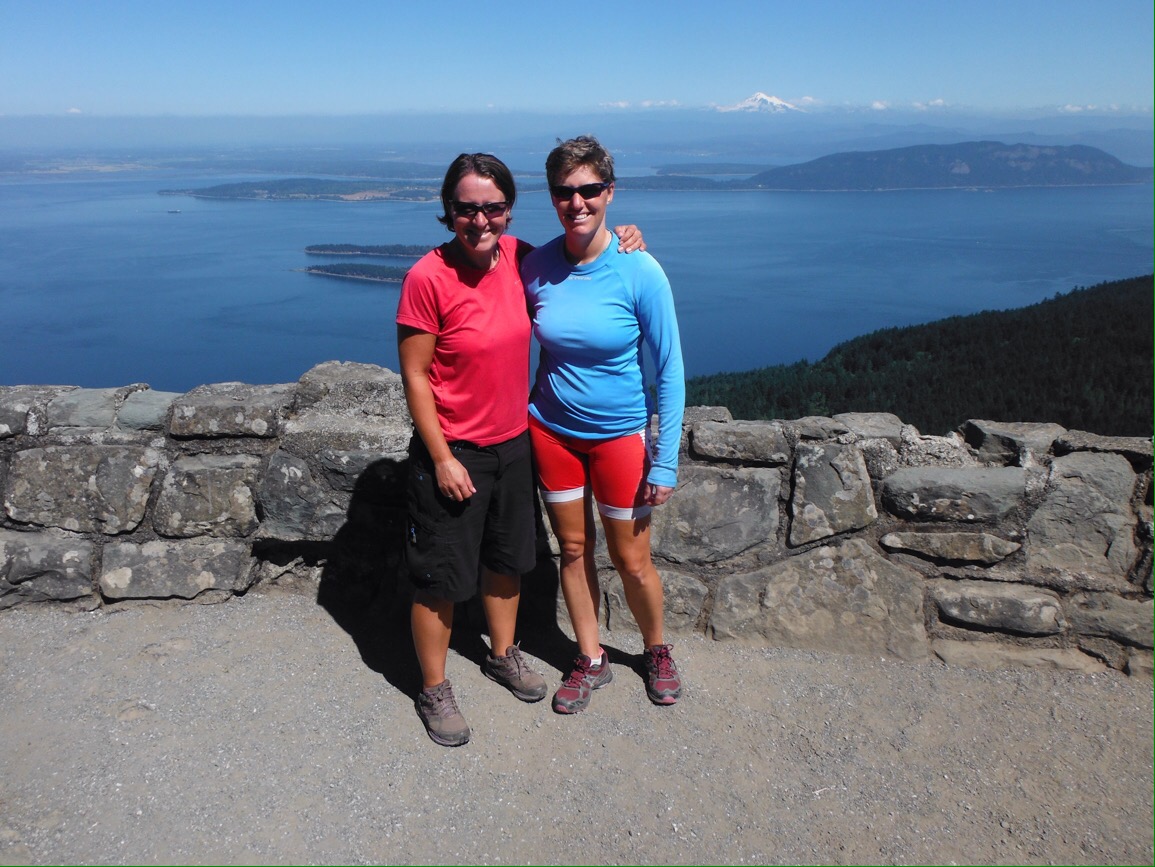
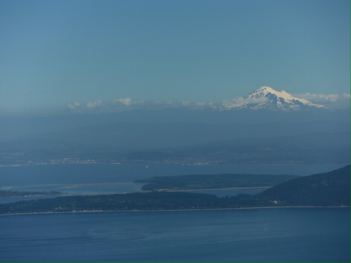
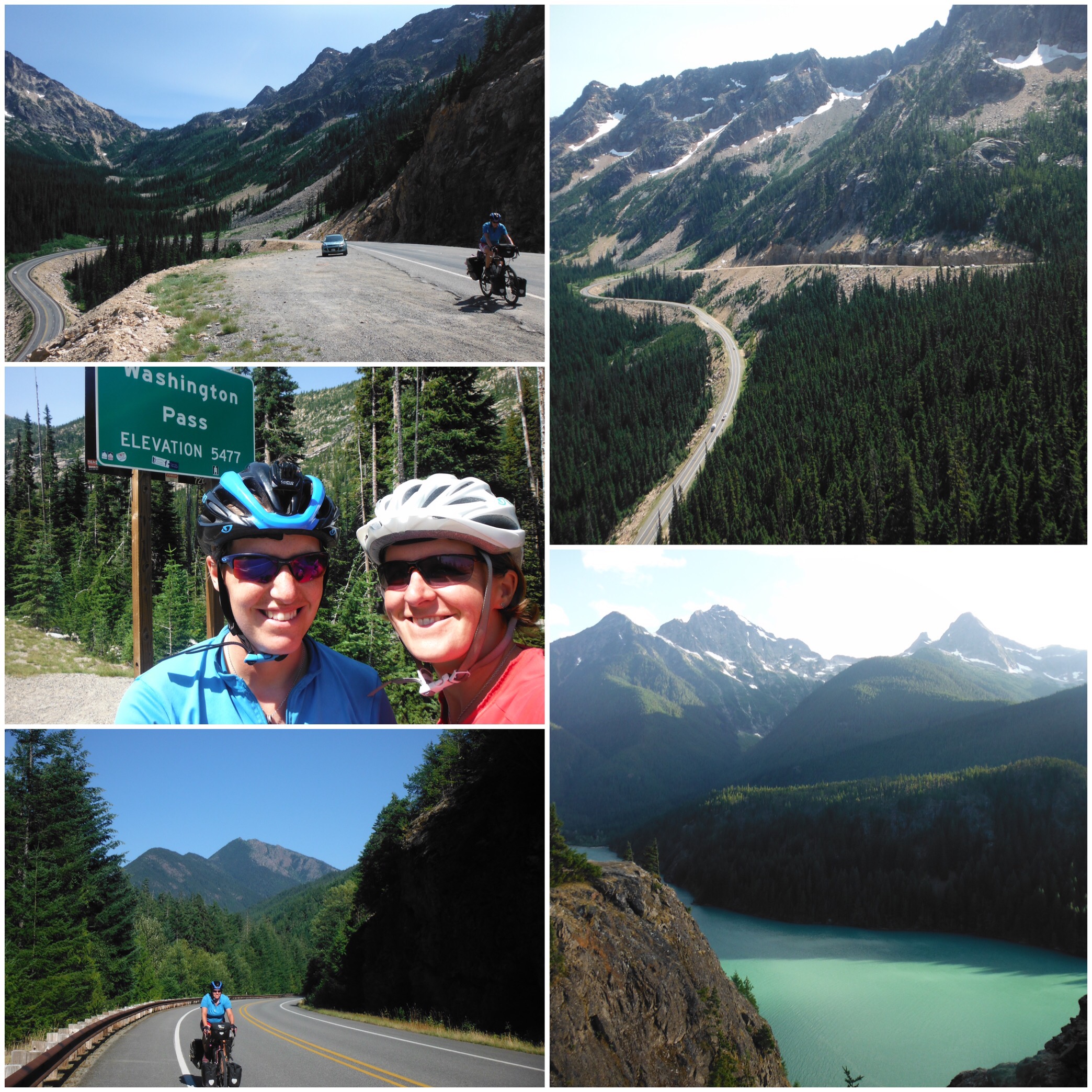
A great thing about the islands is that once you have paid to get there from Anacortes, the inter-island ferry is free for foot passengers (and bicycles) so once you are there you can ferry to the other islands as much as you like for free. So we did. The first day all we did was take the ferry to San Juan Island, the biggest of the group, eat fish and chips and ice cream (separately), then take the ferry back. On the second day we stretched ourself a bit more and took our bikes to Orcas Island, the hilliest one, and rode up to the highest point on the islands. This was a 40 mile round trip with 5 miles steep uphill to the summit of Mount Constitution at 2400 feet. It was 8-10% grade for most of the climb, which our unloaded bikes managed without a problem. From the top the view was spectacular over the islands, and in the distance you could see the snow-covered Mount Baker back over the border in Washington.

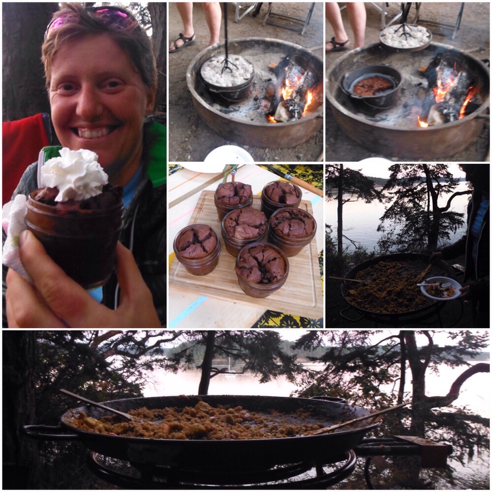
Our campground was small and quiet, and right by the beach. As with most North American campsites, it was full of people who take camp cooking very seriously. One night we were treated to paella cooked in a proper paella pan, followed by individual chocolate puddings cooked on the campfire in a Dutch oven. It doesn’t take much to beat our pasta dishes but this was some serious camp cooking, and we enjoyed testing the results.

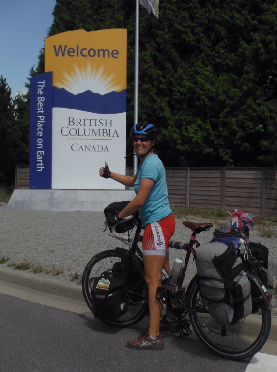
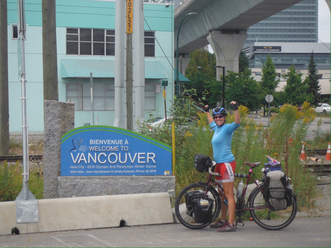
After four days it was time to head to Vancouver, a couple of days ride north. Here we planned to have a proper holiday, and hang out with people we knew for the first time in months. As we crossed the Canadian border and arrived at The Best Place On Earth (British Columbia is very nice, but that’s quite a claim), it felt maybe like this was the end of our coast to coast trip – a familiar place where we were going to see familiar people. Welcome to Vancouver!

Thanks to Pat and Don; Jude, Carrie and the rest of Team Apple; John and Bill for so,e company on the islands; the Seattle campers for the paella and Dutch oven cooked goodies; Reid, Erin and family.

Cycling Washington 20: scenic and sweaty

My arrival in Idaho was bumpy. We needed a safety pin and tweezers to extract the puncture-causing wire from my tyre. It’s times like that I feel grateful to have a doctor on hand. It was a quick ride to Bonners Ferry, and a lovely one the next morning to Sandpoint, via an ice cream and the valley of a chase in the real Falcon and Snowman story.

Sandpoint, Idaho

Just when Idaho seemed delightful (we had met nice people, scenic riverside cycling, etc) it went nuts. In the last 10 miles before the border we saw all of these. Yes, bottom left is a public toilet. They should really get in touch with the Albanian football stadium we visited to share good practice.

It is was exciting to get to Washington – our last new state before the ocean. Maybe this made Jo a little giddy. She went into a supermarket to get some ice cream and bought a three pint tub. Apparently it was cheaper than one pint. We ate it sat outside the cloud Forest Service Ranger Station in Newport. I’m relieved to admit that we didn’t quite manage it all but ate enough to make us feel unwell for the rest of that day’s ride. Jo hasn’t been trusted to buy ice cream since.

The next day was very hot. We opted for fizzy pop instead of ice cream and stopped for some chips at almost the top of the big hill. Our target was a wonderful bike hostel we had heard about. It was so sensational we decided to have a rest day. Good news – big downhill to the town to get food for the rest day. Bad news – long uphill in very hot weather with food to get back. I had a wobbly pedal though, so we made the trip, got pedals and a lot of food. We had some tough riding ahead.

Who doesn’t want to take a super side trip? (It was our route anyway. No detours this near the end).

The next day was even hotter. It turned out eastern Washington was having a heat wave, perfectly timed for our biggest climbing days since Colorado. Between us and the coast were five passes as state highway 20 winds through the North Cascades. Two of the days had more than 1500m of elevation gain.

Between the passes were scorchingly hot valleys. I don’t think I have ever sweated so much as during those few days. To exacerbate the heat/sweat/thirst problem Washington turned into a sort of squashed up Wyoming. Suddenly there were funny coloured rocks, no trees and it smelled of the sagebrush. The only differences were the closeness of the hills and the fact that we could always see at least one house.

Wyomington

We didn’t get out of Wymashington until we began the Washington Pass climb. The others had been a bit hard but this one was a real toughie. It was much steeper and had a dramatic switch back that resembled Sunwapta on the Icefields parkway. Fortunately it was much cooler and a real bonus was a friendly SAG wagon crew at the top who shared some of the snacks their road cyclists didn’t need.


The scenery was wonderful on the way down and we had a great night camping by Diablo Lake. We were aiming for Sedro-Woolley for our last night before hitting the ocean but had a great deal of trouble remembering this name. We struggled with it so much we decided to ride straight through Sedgely Woollen to Burlington. On Sunday July 31st, 102 days since leaving Boston we were only 20 miles from the Pacific Ocean.

Thanks for this sweaty section to: Bob & Diane, Steve, Meg, Robyn & Adele, DiAnne & Boyd, Larry & Lynette, Shelley & Barry, the SAG team, the water for cyclists providers.

Bear Glacier Hill Road

It is often said that we have weird place names in the UK (Cold Christmas?). As we have got further West there seems to be a generic template for road names. Montana has got this totally sewn up. To create your own you just need the following… 1. A status adjective. Examples include: Lost, Tall, Dead, Hidden, Blue or Montana favourite, Big. 2. A relevant noun. E.g. Horse, Pine, Fir, Lake, Creek, Church, Bear, Market. 3. Place or geographical feature: Mountain, Hill, Forest, Pass, Valley, Ranch, anything unused from the list in 2. So you end up with something like: Lost Horse Creek Road. This makes directions very confusing. Imagine you are tired from the headwinds (yes, we still have those), probably hungry and definitely a bit sweaty. Someone is explaining that you take Tall Pine Ranch Road up to Hidden Creek Hill Trail then take the left fork at Big Fork or was it maybe Big Arm, or Big Sky?

Cattle Mountain Road. Probably. Just like Montana should look.

Despite these navigational challenges we had a wonderful two weeks in Montana. Like so much of the USA it is very good at being exactly like Montana should be. Our first day’s ride was alongside a lake formed after an earthquake (naming guidelines: geological incident + geographical feature = Quake Lake). The sky was blue, the trees and mountains tall and the rivers populated with fly fisherman. We kept a close eye out for Robert Redford. For the first time in ages, the wind was helpful. When we turned north it blew us to Ennis, where we camped in the backyard of a whiskey distillery and had a picnic dinner outside the public library. Living the dream.

Before the earthquake, these trees used to be a forest alongside a river.

The next day we had some really good apple pie. Even better, it was at a cool old bakery in a gold rush ghost town. These two days of tourist attractions and information signs were really welcome after all the emptiness we had ridden through. Sadly the helpful weather didn’t last. Despite assurances (/lies) from west-to-east cyclists that they had loads of headwinds it wasn’t at our backs again and there was the odd thunderstorm to hide from. This gave us plenty of chance for ice cream sampling while sheltering outside supermarkets. Huckleberry became the new fave. Who knew it was even a real fruit.

Welcome to the Wild West. Gold rush towns Virginia City and Nevada City.

We rode over a load of really big windy hills (Tall Windy Hill Road) and questioned our sanity and life choices. It was hot and the air really drying. Much like Wyoming. If you are a cycling keen bean and would like to recreate this sensation in the comfort of your own home you could try this. Ride your turbo trainer really hard on a high resistance next to a radiator whilst a few friends point their hair dryers at your face, set to high. Alternatively you can use your imagination… Say you were a grown up and drank a lot of dry white wine, maybe whilst at university when life was less sensible, then fell asleep without drinking any water, and then when you woke up the next morning you put your head in a fan oven, that would feel like cycling uphill into the wind in the western USA.

Chief Jo taking a break from the hills. Our final divide crossing.

We took a rest day in tiny Wisdom, watched Wimbledon and the Euro Final, and wondered if you had to live in Wisdom before you could move to nearby Wise. For a whole day we sat on a sofa, or a chair, looked outside and the rain, and ate. It was amazing. A few days later we made it to Missoula, home of the Adventure Cycling Association. We were excited about this because long distance cyclists get an ice cream and their bikes weighed. Jo was especially looking forward to it as she was convinced that her bike was heavier. In actual fact it turned out that we are packing geniuses, Jo 94lb, mine 96lb. As we had just been to the supermarket and food goes on my bike we are probably about even most days. This weight didn’t include any water, so for the metrically minded the bikes and kit total at least 45kg each. As I mentioned, questioning sanity and life choices.

Clockwise from bottom left: 1. Bike weighing, a delicate operation. 2. Carrying the essentials in the bar bag. Actually a bar. 3. Our mugshot at the ACA. 4. We met a man from Rothley, Leics outside who took this one. It’s a small world in cycling.

It was a few days ride to Glacier National Park. On the way we took in the Smoke Jumpers Visitor Centre and had an excellent tour. These firefighters wear kit that weighs about the same as our bikes and parachute into forest fire areas. Very impressive indeed. The awesome staff also rescued Jo’s tea flask and posted it to us in Republic, Washington. Amazing. We treated ourselves to some new gear cables and bike chains in Polson. Rock and roll. The route went along Flathead Lake where there was great swimming and even better in-season cherries for sale by the side of the road.

Clockwise from bottom left: 1. Jo got some cookies as big as her face as a gift at the farmers market in Big Fork. 2&3. Real smoke jumper training jump prep. 4. Fake smoke jumper Jo. 5. Still hilly around here.

Lakes instead of showers continued in the National Park, but we didn’t mind because it was probably the best place we have been in the USA. Incredible scenery, waterfalls, wildlife, lakes. We decided to have a few ‘rest days.’ The big attraction for cyclists at Glacier is the ‘Going to the Sun’ Road. To get up to Logan Pass at about 2000m the scenic road is hacked out of the side of the mountains. As it was a rest day, we left the bags at the campground and took the shuttle bus to the top with our bikes. We rode down the East side, turned around, rode back up to the top and then down the West side to the camp ground, stopping to walk around a lake on the way. We found the perfect sports recovery drink – a Huckleberry beer (of course). You didn’t think it was an actual rest day?

The next day we went for a hilly walk (hike in American) to loads of waterfalls. It was beautiful. On the third day we were tired, so we decided to do 2 shorter walks and a shorter bike ride. On the first walk we saw a grizzly bear and cub in the absolute best situation. We were at a safe distance, there were loads of people around and we could have outrun at least 75% of them. It was amazing. The cub gambolled around whilst mum sedately crossed the person-boardwalk. Glacier rocked.

Montana had more great scenery for us before we left, but no more showers. We camped at Dickie Lake, hung out with some other cool teachers and swum in the lake for our wash. The next day was hot, windy and very pretty alongside Koocanusa Lake. There wasn’t much drinking water or shade and it was hard keeping cool. We had an essential dip in the afternoon to de-sweat. A kind Canadian family saw our heat induced fatigue and gave us some ice pops.

Montana’s parting shot was our first puncture (‘flat’) of the US. After 4000 miles we weren’t too upset.

Thanks to: The friendly Utah family in West Yellowstone, the vendors of the Big Fork Farmers’ Market, Tim & Carrie, Rachel & Kurt, AnnaMarie & Tom, Mike the mechanic, Suzanne & Pam for introducing us to Skipbo.