Walking the Hillary Trail

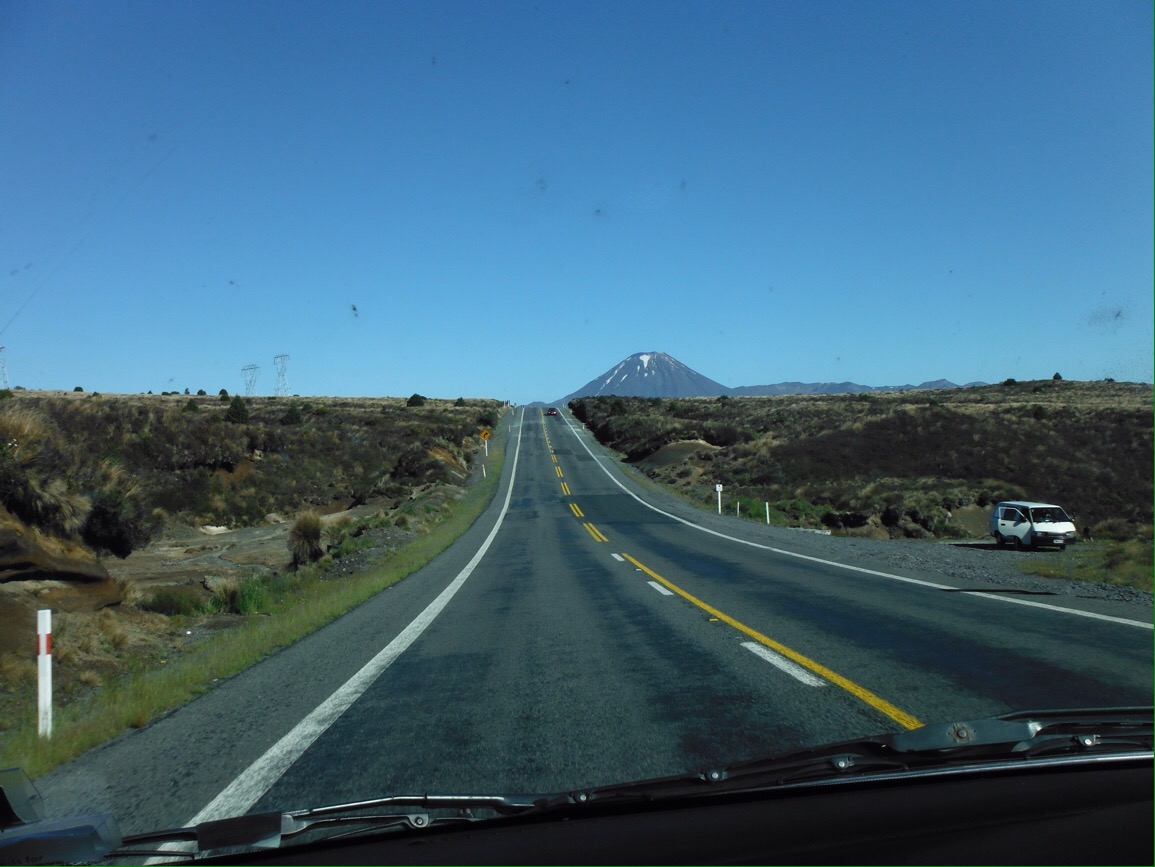
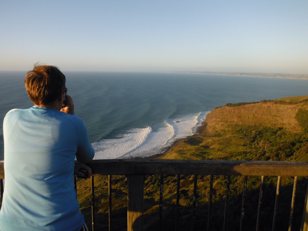
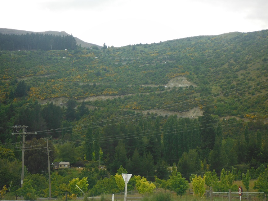
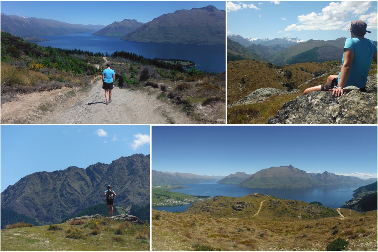
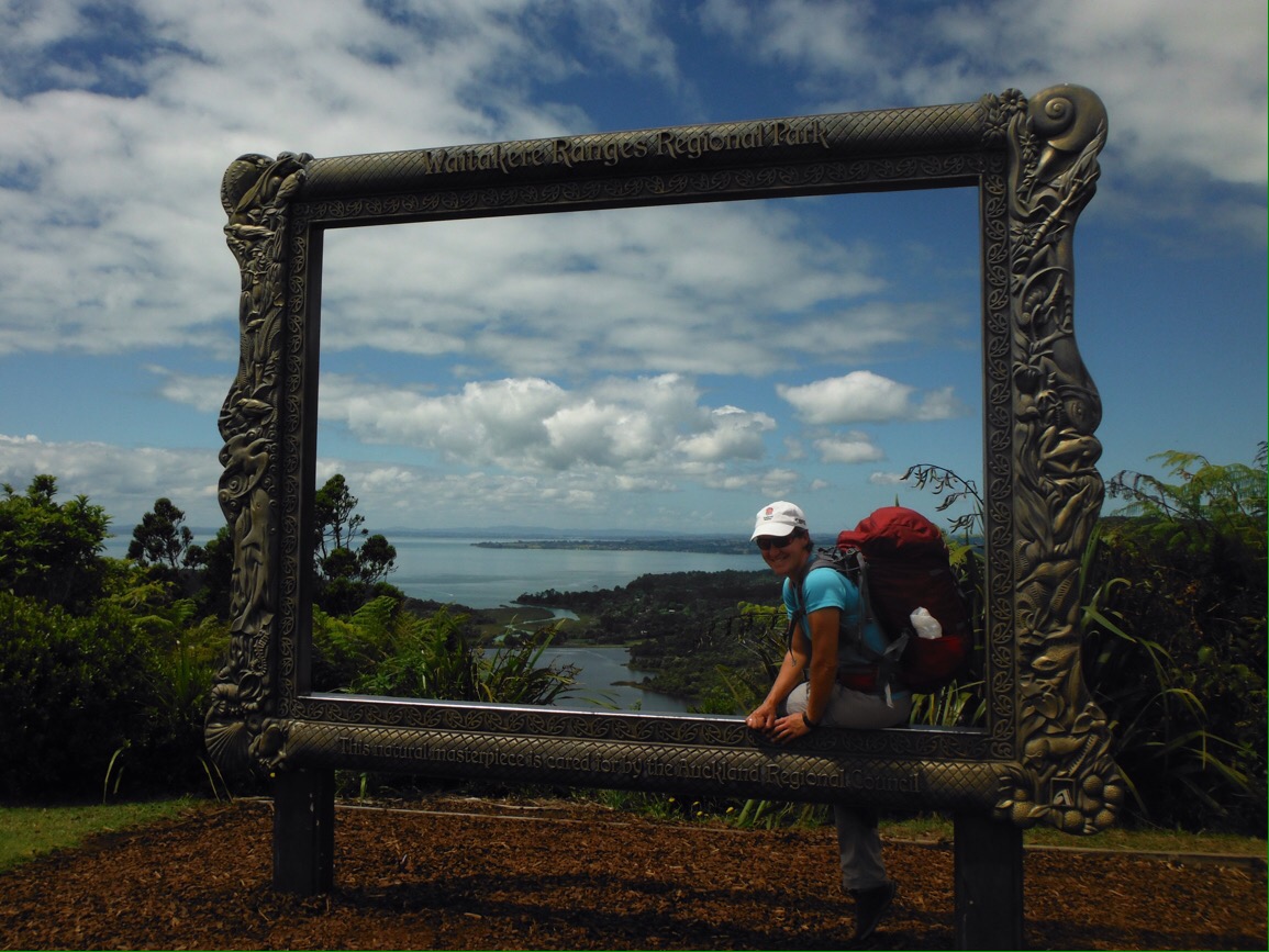
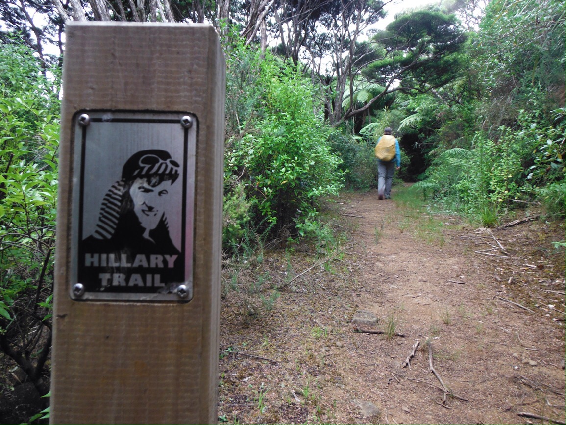
There are plenty of well known walks (tramps to use the local term) in New Zealand and we were keen to do at least one overnight hike whilst here. Based in Auckland over Christmas and New Year, the 77km Hillary Trail (named for Everest climbing kiwi Edmund) in the Waitakere ranges west of the city seemed a good pick.

Should you be considering tourist opportunities in the Auckland area, there’s a reasonable amount of information available to help you prepare for the trail. However we found some discrepancies between the content of the reading material and what you will actually experience in real-life…

Jo at the start, clean and sweat free

“The Hillary Trail is a challenging four day/three night hike”

Translation: you can do this is four days if you would like to walk 27km on the last day, with only one water source on route, finishing at a beach ‘town’ where there is no public transport at all. Consider an alternative earlier finish point. Do not prepare by participating in Christmas, a well known festival involving much chocolate and little exercise.

Pretty sure that one silver D of E between two counts as experienced?

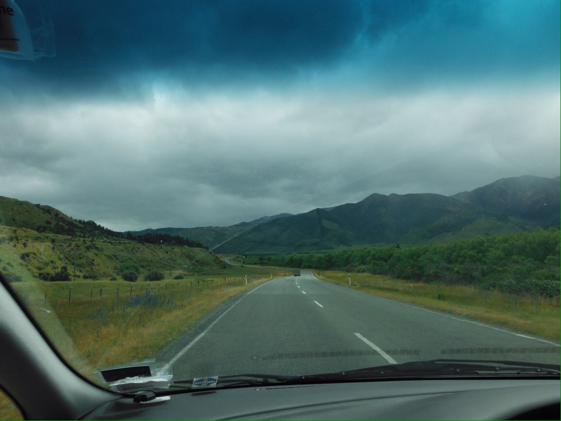
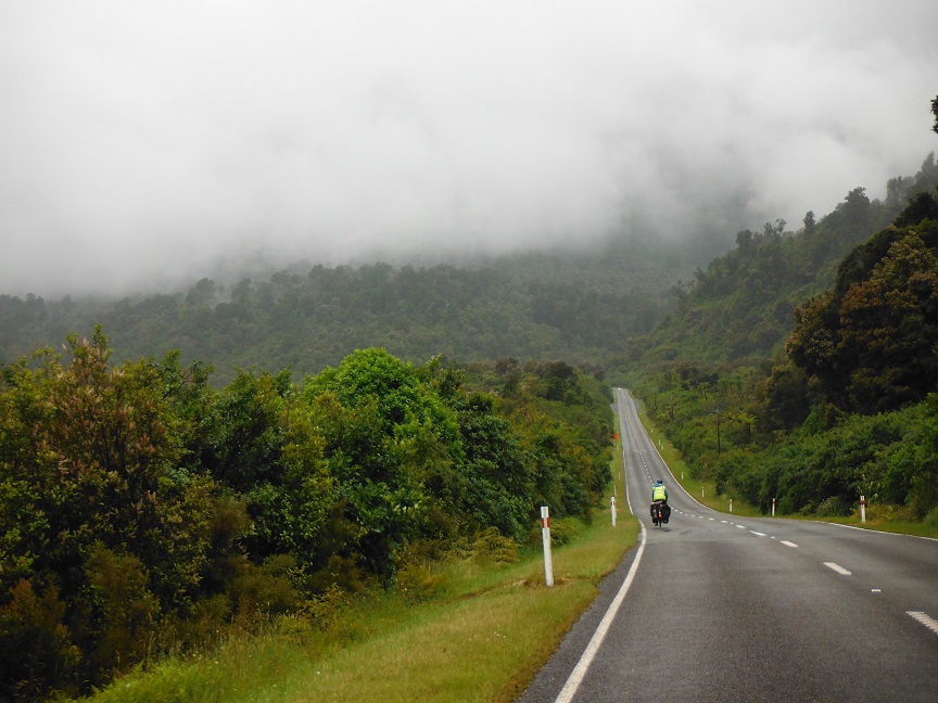
“It is likely to rain for at least part of your trip”

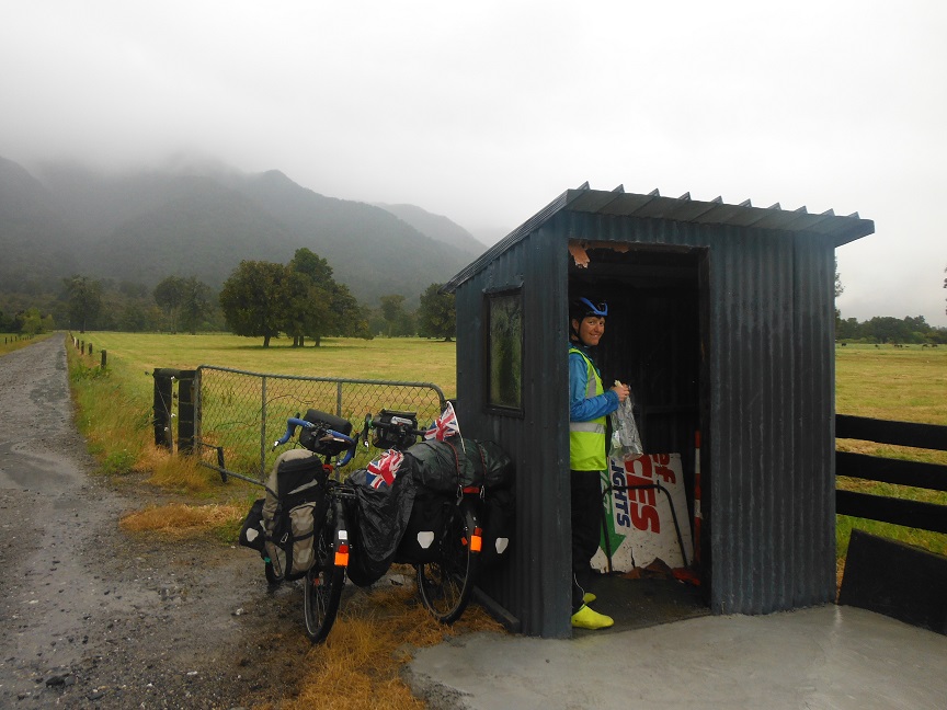
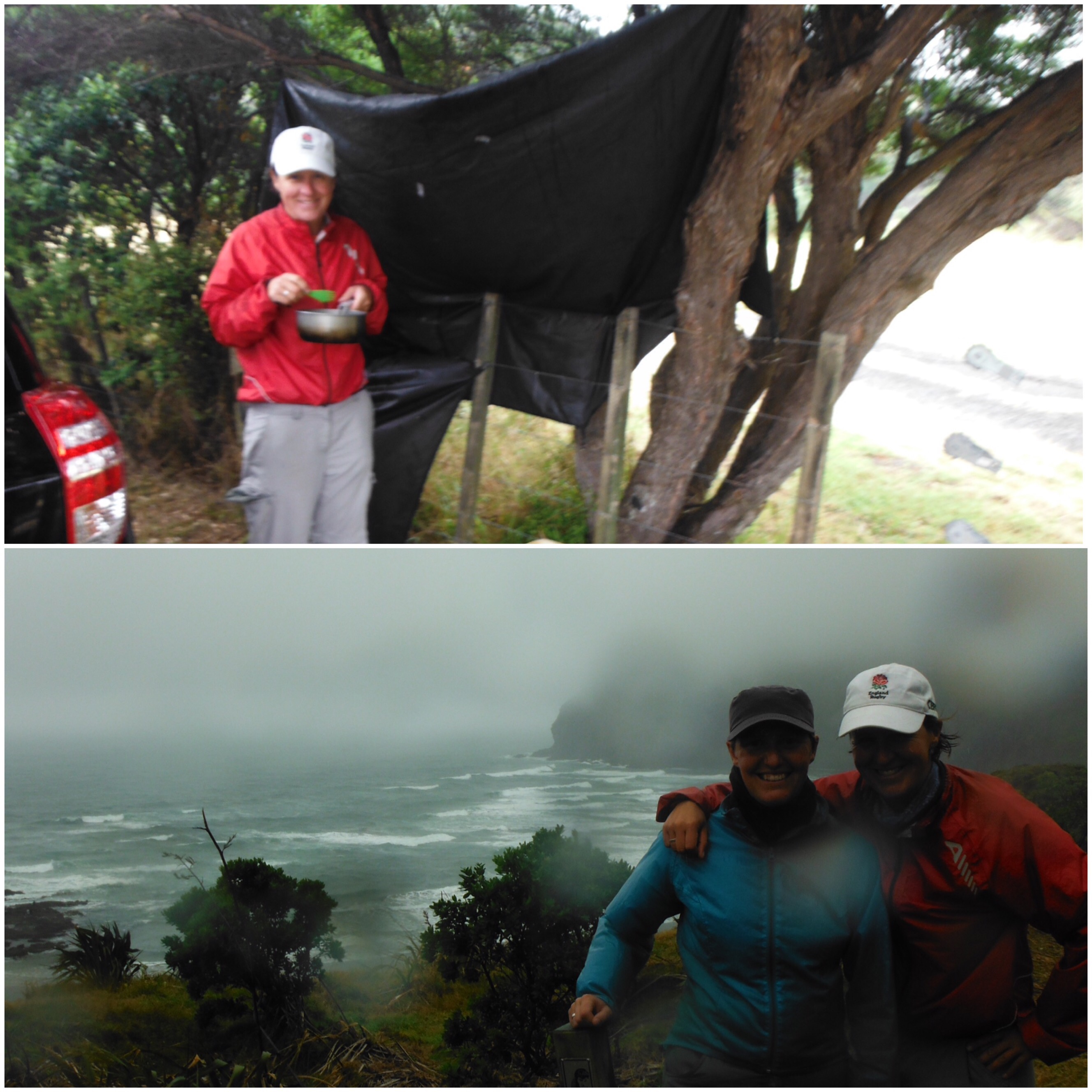
If you have been lucky and avoided rain for the first few days by having extremely hot weather, on day four it will piss down while you are waiting for your lift. Make sure you are able to construct a shelter in the car park using your tent groundsheet, a fence and a hair bobble.

It’s been a dry summer in Auckland. Apart from this day.

“Many tracks will be steep, rutted, rooty, slippery and muddy”

All tracks will be like this or made from really sharp stones that you can feel through the soles of your trainers if you complete the walk in the one pair of shoes you have been wearing for the last fifteen months. (See also below).

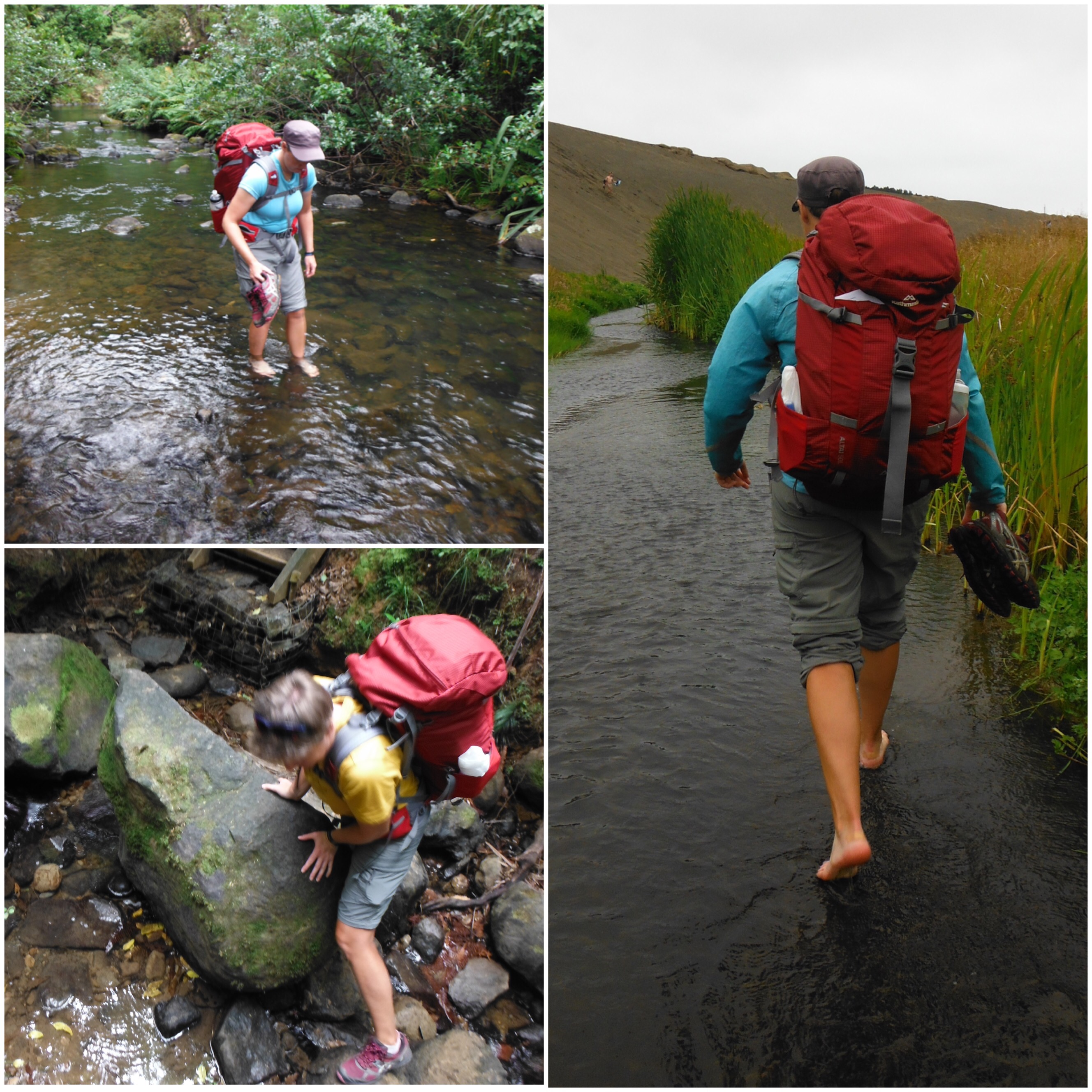
“Some stream crossings may be difficult”
Some stream crossings may in fact just be streams, so take off your shoes and socks and roll up your trousers. In some areas the track might actually be a stream for up to one kilometre. Don’t bother trying to stay dry. It’s about to rain anyway.

Top Left: Got to knee deep. Bottom Left: Scrambling to cross a waterfall. Right: The track is a stream, Lake Wainamu.

“You will have to carry a heavy pack with your tent, sleeping bag, extra clothing and four days worth of food”

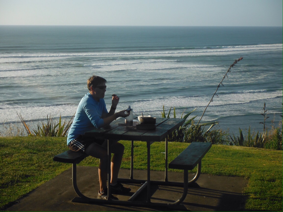
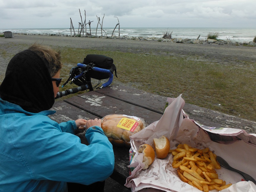
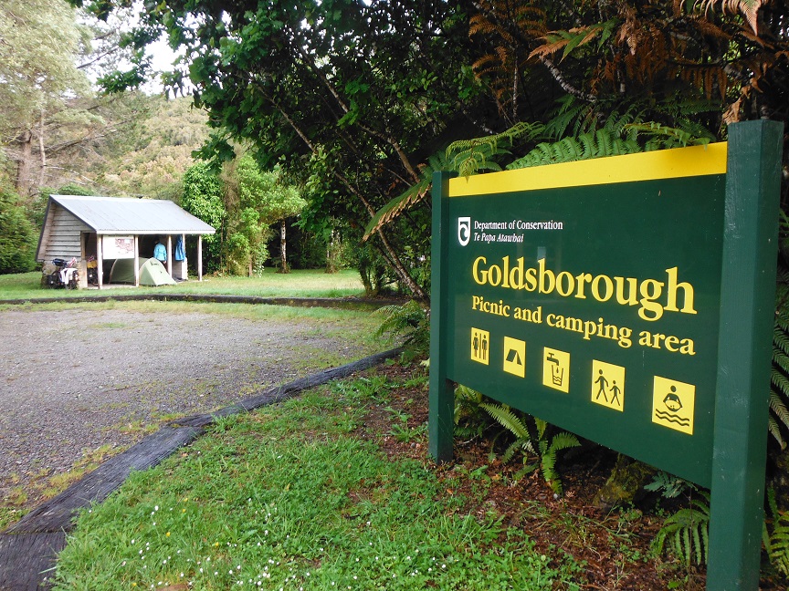
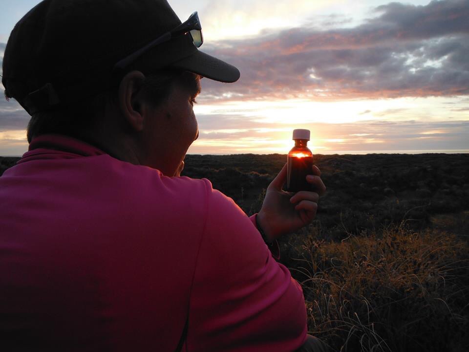
OR you can pack three days worth of food and eat four pies between two when you get to Piha. (Important to try all the flavours: winner Chicken Balti). We packed super light and given the limited/very expensive supplies at Piha had a bit of a small lunch on the last day. We carried the day pack that is usually strapped to Jo’s bike and a borrowed 50L pack, swapping bags about every twenty minutes. We did squeeze in a couple of luxury items for New Year – a mini Brie and a couple of servings of baileys in a medicine bottle. Campsites are basic, water needs treating before drinking, long drops only and showers are the al fresco kind – wash in a stream or the sea.

New Year’s Baileys in the sand dunes
Piha. Translates from the original as ‘Baywatch with Pies.’ The black sand burned our feet.

“The fitter you are, the more you will enjoy the experience”

We were surprised that despite doing very little walking, our base cycling fitness was of huge benefit. We didn’t feel wiped out at the end of each day, and weren’t particularly sore or stiff in the mornings. So we did really enjoy it. The scenery was fantastic and it was a satisfying physical challenge, just like bike touring. There were a other hikers that were moving the campground with interesting gaits by day four though. The main difference between walking and cycling is that there is no coasting time when you walk. At least if you ride up a big hill, you get to zoom down the other side. On foot, the downhill seems even more leg damaging. The closest thing to freewheeling is a flat grassy track. I think there was about 400m like this on the Hillary Trail.

Approx 0.5% of the trail was as flat as this.

“A challenging wilderness adventure designed to introduce families and young people, properly prepared, to the joys of multi-day tramping.”

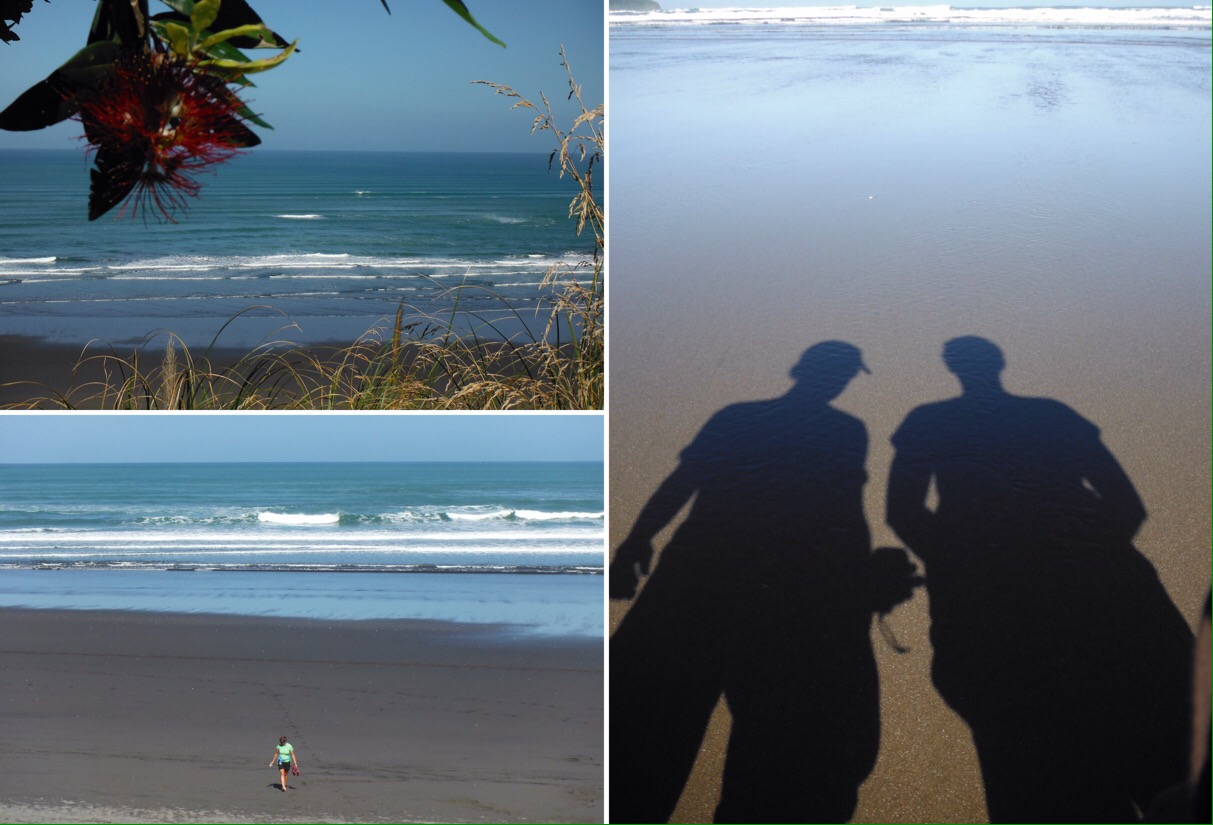
Despite being only about 30km from Auckland, the Waitakeres feel properly wild. A lot of the walk is in dense rainforest, and it’s dark enough at night to see the Milky Way. In terms of family participation, if you can answer yes to the question “Are you the Incredibles?” feel free to go ahead. If not, give some very serious thought to the length of the days, the uneven nature of the tracks and the amount of food/water you need to carry.

Brill scenery every day

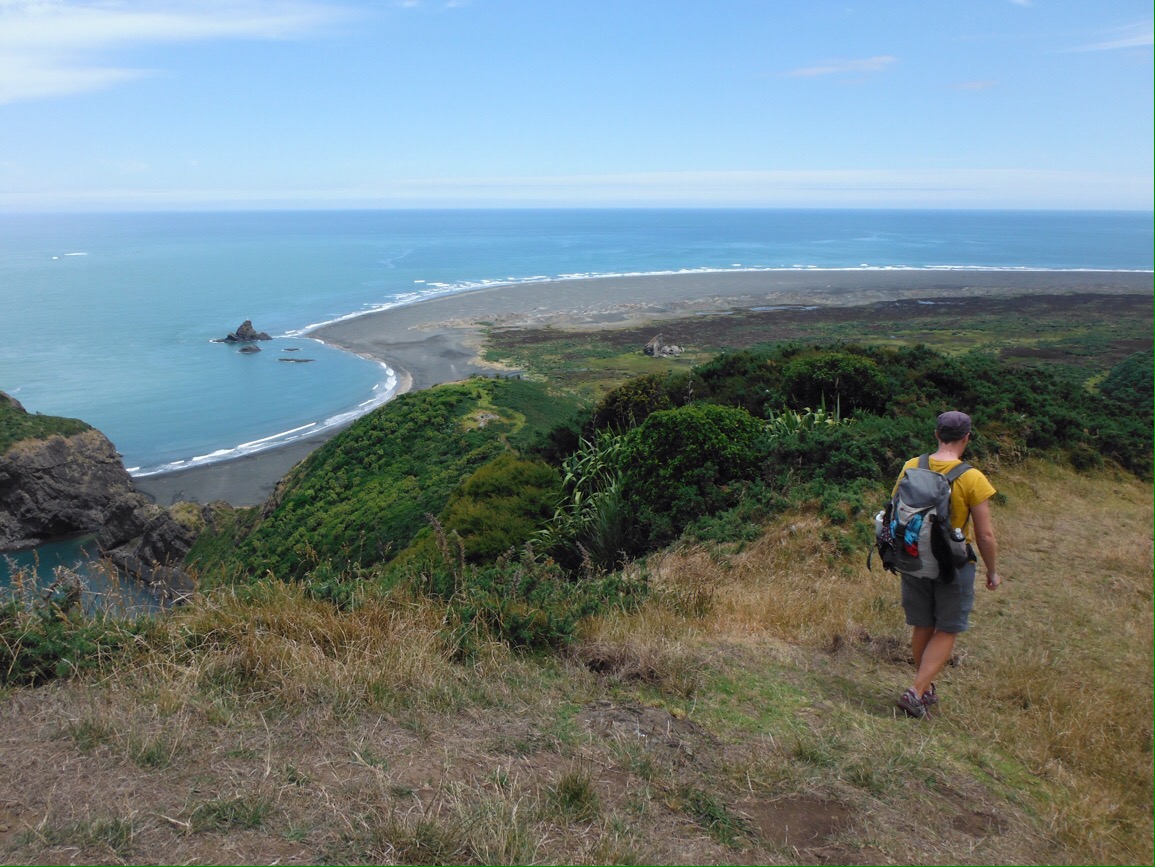
We had a great time. The scenery made the sweating more than worth it. We loved the self sufficiency of carrying everything we needed on our backs, even if squeezing water through the filter bags did get a bit old by day three. We were pleased and surprised that our wicketkeeping and hockey knees held up to the descents and there were no lasting injuries, not even a blister. It was awesome and we will be looking for other multi day trips in the future.

Thanks to: Val for bringing much neeed sandwiches to the pick-up point. The English people that donated some spicy noodles to our baked bean dinner on the last night.

Ps. If you’re reading this HRH, Jo didn’t get to do D of E at school, it would great if you could pop a badge in the post for her.

An extra four wheels

To get back to Auckland in time to celebrate Christmas with our NZ famil-Lee we had to find an alternative to cycling. Flying was an unattractive prospect and buses are still not on a full schedule after the Kaikoura earthquake so we investigated how an extra four wheels might help us. Most people who rent cars and campervans here pick up in Auckland and drive somewhere in the South Island to fly home. So luckily for us, rental companies need these vehicles driving back up north and offer nice perks to counteract the fact that they need them back as quickly as possible. We managed to book a small self-contained camper for free, as long as we took no more than four days to get from Christchurch to Auckland (1300kms). All we had to pay for was one passenger on the ferry, and the petrol. Deal.

First of all we had a day to look around Christchurch. The city is still in recovery after the major 2011 earthquake that killed 185 people and destroyed most of the CBD. Since the last time we were here (2012) it looked like the city is progressing well – piles of rubble have been cleared, empty lots have been tidied up and there are a number of new flash buildings. In 2012 the re:start shopping mall in bright shipping containers just had a handful of shops; now it is a thriving shopping space with cafes, street performers and food. It was very busy. We liked Christchurch a lot. It seems like there is plenty going on, the regeneration is an exciting time, it’s a manageable sized city and there’s even decent cycling infrastructure.

Clockwise from top left: Big chairs in the CBS; 185 white chairs, one for every life lost in the 2011 earthquake; re:start shipping container mall; damaged cathedral; interior of the new temporary “cardboard cathedral”

But we had Christmas in Auckland to get to. After not driving for well over a year we were a little apprehensive about getting behind the steering wheel. How would it feel to be travelling so fast? We had other things to think about too. How much does petrol cost these days? How often will we need to fill up? What’s the speed limit? Where will we park? How close can we get with the car? All things we haven’t had to consider in a long while. Especially not the speed limit.

Kitchen; bedroom/bike storage

The camper itself was well thought out, with a small kitchen area at the back and a fold up bed/table in the main area. It came with everything you might need – all cooking stuff, real mugs, chairs and table to sit outside, gps, chargers, there was even the luxury of huge pillows and a duvet. Debs was excited to find a coffee plunger; I was more excited about a plug in tourist gps radio (that turned out to be dull). After listening to our iPod through its own speakers for months we could plug it in to the car stereo. We even had two big fluffy towels each. Not that we planned on showering, but nice to have them just in case. It also had a porta potty and a way to store waste so we had that all important “self-contained” sticker on the back. These are highly sought after as new freedom camping rules means that there are loads of designated free camping sites, but only if you have the magic sticker (so you won’t go in the bushes in the night). We were now one of those people who we were jealous of when looking for a free spot to pitch our tent and finding “self-contained only” signs. Life was good. It was luxurious even.

Squeezing the bikes in around all of these luxury items was a bit tricky but by taking the front wheels off they stood between the bed and the front seats. Driving out of Christchurch was easy, it’s hardly a big city, and we had the pleasure of going to a supermarket knowing we could buy what we needed for the next few days all in one go. No need to worry about the weight. We bought an extra couple of tins of beans ‘just in case’. There was even a cool box so we could have real milk in our tea rather than powdered. These are the type of things we can usually only dream of.

As the road through Kaikoura (the shortest way to ferry to the north island) is closed following a landslide after the most recent earthquake, we had a seven hour drive ahead of us to get to Picton. Excitedly we hit the open road, marvelling at how fast we were travelling, how we couldn’t even tell the road was going up (we had a pass to get over), and having nothing much to think about other than which album to have on next. The novelty lasted a couple of hours. That was all it took to realise how much we loved cycling.

It was boring, particularly being the passenger. I think I fell asleep for a while. (While Debs was driving of course.) Everything went by so fast, it was hypnotising. On the bike you can stop and take a picture whenever you like. In the van it was more “that’s a good view can we… oh it’s passed now. Never mind”. We were up the pass and over the other side in no time, and I felt like we hadn’t really had time to look properly at the scenery. Both of us had to really concentrate when driving to make sure we didn’t gaze around, something you do without thinking on the bike. It was uncomfortable sitting still in the same place for so long, and there weren’t many places to stop and stretch your legs. But mostly we felt lazy. We had become so accustomed to the feeling of satisfaction gained from making distance purely through physical activity. It was strange because we expected to enjoy being able to travel so effortlessly, but it just felt wrong somehow. It also meant we couldn’t stop and eat every ten minutes like we usually do. That’s not to say we weren’t pleased to be in the van when it rained for the last few hours to Picton.

Driving up towards Lewis Pass

It was pretty late when we arrived at a good free camp spot by the beach. Dreams of just being able to park up, get in the back and go to sleep within the space of a few minutes didn’t quite work out as we first had to manoeuvre the bikes out and lock them outside, but it was still a much faster process than tenting. We woke to an amazing sunrise over the river and cooked up a porridge breakfast that we could sit on chairs with backs to eat. Whilst the actual travelling wasn’t as fun, the process of camping was made a lot easier with the van.

A three hour scenic ferry ride got us to the North Island and we had another mammoth drive to make sure we could meet up with friends from the UK the next day.

Ferry ride across the Cook Straits

That night we slept by the side of the Desert Road at its highest point (over 1000m) on the edge of Tongariro National Park, in the shadow of Mt Ruapehu. Mt Ngauruhoe (Mt Doom to LOTR fans) was also in view. Cooking rice and tuna as the sun set behind the mountains was pretty special, even if we hadn’t pedalled ourselves there. The next morning the sky was clear and the views even better. It was pretty cold up at that height so we welcomed the duvet.

Sunset over Mt Ruapehu
Sunrise at Mt Ngauruhoe (Mt Doom on Lord of the Rings)
Not a bad view to wake up to (and look at from a chair with a back)

After a second breakfast on the shore of Lake Taupo we drive round to Huka Falls to meet friends for a walk and a soak in the natural hot pools. After not seeing anyone from home since April this was amazing!

Huka Falls
Soaking in the natural spa pools

Time went too fast and we had to hit the road again. Searching for our first west coast sunset in New Zealand we drove north via Raglan, a west coast surf town with some great beaches. The sun set over the sea, we again cooked with an amazing view and the next morning we even had time for a couple of hours on the beach before dropping the van off and getting back on the bikes. A ride, train, ferry and final ride got us back to the North Shore.

Sunset over the Raglan surf beaches
Dinner
Morning beach walk, Raglan

Overall it was a fun way to do the journey we had to do in the time available. Much better than flying. Being able to camp anywhere was nice, and we had three great camp spots. But as a way to travel, cycling still wins. By far. On a bike you experience everything that is around you, so intensely. The weather, the temperature, the wind, sounds, animals, traffic, road surface, you feel every little thing. Being in a vehicle neutralises this. It could be boiling hot or freezing cold outside – we were a constant temperature. The road could go up or down – it felt the same to us. The wind could be roaring, the trees blowing or the streams gushing – all we could hear was the engine and the stereo. We just felt so detached from the environment we were travelling through. Want an adventure? Get a bike! [disclaimer: it is very tiring cycling everywhere.]
Thanks to Gen & Nick (again); Viv & George (again); Hels & Gaby for the English company.

Riding NZ’s west coast: There is such a thing as a free lunch

Last time we cycled in New Zealand we didn’t make it to the west coast of the South Island. Everything you hear makes it sound a must-see – glaciers, rainforests, beaches, quiet scenic roads – apart from the one fact that it rains there. A lot. The Southern Alps that run down the spine of the island do a great job in trapping all of the rain and cloud, depositing it on the west coast and keeping the other side of the mountains nice and dry. We thought back to Oregon in September when we had a stretch of a week or so where it rained every day. Not only does this make everything in our current way of life (cycling, cooking, camping, stopping to pee) harder but it also pretty much ruins the good views that are supposed to be the reward for the effort put into cycling. But hey, it can’t always rain. We crossed our fingers and rode towards the rainy coast, determined to see a glacier or two.
dscf9709
To get to the west coast from our rest stop in Queenstown we first had to get to Wanaka by riding the highest paved through road in New Zealand, crown range road (that’s now two countries we have ridden the highest paved through road). It is crazy steep, the start involves switchback after switchback up the side of the hill, and then it snakes up to the top of the pass so steeply it was almost impossible to push the pedals round.
The switchbacks up
The switchbacks up
Tight hairpin bends
Tight hairpin bends
The view back down the switchbacks
The scenery is pretty barren up to the top, though the gradual descent down the other side follows a pretty cool gorge for a while and passes through Cardrona, famous for its old hotel. But the gradual descent was totally ruined by a vicious headwind. We arrived in Wanaka at 6pm shattered and out of the three campgrounds in town, chose the pricey one with a hot tub to soak our weary muscles.
dscf9581
It doesn’t even look that steep…
dscf9584
Finally!
From Wanaka it was two days riding to Haast on the west coast. We were tired from the previous climb and it was pretty miserable so on the first day we stopped and put the tent up at 3pm by a lake and sheltered from the rain and the sand flies for the afternoon. The following day we had Haast pass to climb, but it wasn’t too bad, much helped by passing an organised cycle ride and being invited into their lunch tent. We were told to take as much as we wanted as they were throwing the rest away; loving food and hating waste like we do we ate a huge lunch and carried as much as we could for dinner that day. Then sadly watched the rest be thrown in the bin. If anyone ever says there’s no such thing as a free lunch, remember this story. Keep the faith. Luckily it was mostly downhill from there as we were so full we could hardly pedal, the sun came out and we caught a rare glimpse of the mountains surrounding us. There were loads of waterfalls just by the side of the road and we were reminded of the beauty of travelling by bike as we could hear them roar before we saw them. We arrived in Haast under blue skies, ate our free dinner and went to sleep hopeful that we had hit some decent weather.
dscf9606
Lake Wanaka. I’m sure it can look better than this…
dscf9635
Lunch. Awesome.
dscf9639
Roadside waterfalls
dscf9660
Yep, it can look good…
It was not to be. The next morning there was low cloud all around us. The mountains that we had seen in existence the day before had disappeared. The road was seriously steep; this section of road is over difficult terrain and wasn’t completed until the mid 1960s. It’s nice to get reminders like these of how young the infrastructure of this country is. It’s easy to take for granted the amount of really old stuff we have in Europe. There’s old stuff to see in New Zealand too but it’s all natural – the oldest buildings are 19th century. In contrast, there’s a church in our small Leicestershire village from the 14th century; this is quite normal. Anyway, the cloud made everything quite dreary, the road was mostly inland with no views of anything and as we arrived at a motel/campground and asked about pitching the tent, the owner said “you know it’s going to p*** it down?” We did know that, we camped anyway, and yes it p***ed it down all night. And all the next morning. In preparation we had booked a room in a hostel in Fox, a tiny tourist town that has little apart from hotels and companies offering helicopter rides to the glacier. Not on that day. We rode through the rain and checked in to the hostel bang on 1pm, the earliest check in time, dripping all over reception. I don’t think the staff were that excited to see us, especially when we handed over an armful of damp cycling clothing for them to hang up in their laundry. The afternoon was spent getting everything dry, making tea in a tea pot, and laying down. It was great. Later I ventured out to buy an ice cream each, though for the same price as two individual ones, I could buy a 2 litre tub – no brainer. (This is not uncommon across the world and only encourages over consumption, which is fine for cyclists (ok, debatable) but not for anyone else.) Luckily there was a freezer at hand so we didn’t have to eat it all that day.
dscf9673
Not much in either direction
dscf9702
Just clouds mainly.
dscf9703
Scenic lunch shelter. You see these by the road, i think they are for kids to stay dry waiting for the school bus.
There are two glaciers that are (semi) accessible from the west coast road, Fox and Franz Josef. We didn’t see any reason going to see both (they are detours from the road), so as the weather was bad as we rode past the turning to Fox Glacier we put all our eggs in the Franz Josef Glacier basket and hoped for a bit more visibility as we rode north. The next morning it was a bit brighter, so we pedalled hopefully out to Lake Matheson, where on a clear day there is a picture perfect reflection of Mount Cook (the opposite side of the mountain to where we had hung out in perfect sunshine the week before). Unfortunately by the time we got there the clouds had swooped in again and the mountains were nowhere to be seen.
matheson
Lake Matheson. The brochure view on the left; our view on the right.
After calling back to the hostel for our stuff and to finish off the rest of the ice cream it was a twisty, hilly road to Franz Josef and it rained the whole time. Undeterred we rode the 5km detour out to the car park, locked our bikes and joined the hoards of other people in waterproofs to walk grimly out towards the glacier. Since 2008 the glacier has retreated around 800m so you can’t really get that close anyway now. We could hardly see anything so took a few terrible photos and walked back as fast as we could. Disappointing indeed. The best thing was that there was an undercover bike storage area where we could eat our sandwiches out of the rain. That night we camped at a lake near a couple of Aussies who gave us a beer and despite the cloud there was even a nice sunset.
dscf9727
Franz Josef Glacier. Behind there somewhere. I think.

dscf9733

Blue skies returned the next morning so we had some decent views and a good ride up the coast, though again the road is mostly inland so there’s not really much to see other than trees. It’s not that I don’t like trees. They just get a bit repetitive after a while. There wasn’t much to see, and we were even refused drinking water for the first time on the trip. In Harihari we stopped to read about the first person to fly solo across the Tasman sea (from Sydney, Australia). He didn’t think he’d get aviation permission for the flight so told everyone he was flying to Perth but flew over to New Zealand instead, half-crashing in a peat bog near Harihari and becoming a local hero. The scenery picked up a little as we crossed a couple of sparkly rivers before camping in Ross, a former gold rush town that once had 2500 inhabitants and now has 300. The old pub is quite quirky and has a camping/campervan area with a kitchen where every single other backpacker was making some variation of spaghetti bolognese. I think we saw five different spag bol meals prepared. We turned a few heads with our rice dinner. Debs even taught a German couple how to open a tin with her Swiss Army Knife. Revolutionary. The town occupied our interests for an hour or so the next morning as there are a few old gold-rush era buildings remaining.

dscf9760

dscf9766
Trees, trees, more trees…
dscf9782
Ross pub/hotel
There’s a new bike route on this section of coast starting in Ross but we only lasted 100m or so on it as the gravel was so loose it was hard to stay upright. Back on the road the wind blew us to Hokitika, as this was the first time we had seen the sea for four days we had fish and chips on the beach. It felt a bit like being in England – it was grey and freezing cold. Hokitika obviously has someone good working in marketing as they have done two impressive things – a driftwood sign on the beach (selfie central) and registered the domain name http://www.coollittletown.com. It was nice to see the sea again but we wanted to get a bit further so we carried on pedalling inland to Goldsborough, another former gold rush town that once had 7000 inhabitants but now nothing remains. We went for a walk from the campground and it’s strange to be wandering around in the bush imagining a decent sized town with shops, banks, a church and a school once existing there. The next couple of days were spent riding back towards Christchurch over the infamous Arthur’s Pass that we had detoured away from over two weeks previously. Doing this to avoid the worst of the weather didn’t quite go to plan…. as described in a previous post
dscf9791 dscf9794 dscf9805
All in all I’m sure the west coast can be a spectacular drive/ride if the weather is right but I’m not sure we’d recommend it to cyclists. Although the road was pretty quiet, the grades are crazy steep at times, there’s not much to see on the way, you’re rarely near the ocean and the people weren’t super friendly. It’s good if you like trees and hills and don’t mind riding in the rain I guess. Or sharing the road with houses.
dscf9809

Rather blustery days in New Zealand

Stepping onto our Air New Zealand flight from Seoul marked the return of familiarity. Announcements were in English, we understood what was going on around us and we were heading to a country we had been to (and cycled around) before, staying with friends and seeing other people we knew. It was all too much excitement and we hardly slept on the flight – not helped by the air steward who insisted on filling up my plastic tumbler with red wine to the very top, and more… “the bottle’s nearly empty, you may as well finish it, just down a bit then I can fit the rest in…” With heavy heads we landed in Auckland and did very little for five days except sleep, drink tea and eat cheese. Debs even made a lemon sponge cake. It was great. Oh and we went to the beach a few times too. The sun was shining, the days were long and memories of camping in -6 temperatures in Korea quickly faded.


New Zealand is about the most British foreign country I’ve ever been to. It’s quite strange being as far away from home as you can be, but being reminded of it everywhere. Plug sockets have a switch. Hot and cold water comes out of separate taps (ok, that’s not a great trait). The words biscuits, rubbish bin and pavement are understood and used correctly. It’s green and it rains in the summer. The national speed limit sign is the same, and we even saw an advert for a car boot sale. Lose a few of the mountain ranges and work on the use of vowels (do you mean peg or pig?) and it’s about there. Rumour has it that familiarity breeds contempt but after 14 months on the road, this was just what we needed.


Flying is our least favourite way to travel, not just because I hate it, but it’s a hassle with bikes and you miss stuff on the way, so it’s always a last option. But we wanted to spend as much time in the South Island as possible before coming back to Auckland for Christmas so had to work out how to get South. Riding there would take out most of the time we had, and public transport options were limited after the recent earthquake had taken out a section of Highway 1 (the main route south) around Kaikoura. So reluctantly we flew to Christchurch, though the views over the mountains were spectacular from above. Landing in the evening we rebuilt the bikes in the less-than-impressive bike assembly area which took forever in the fading light and without a decent pump we rode the 12km into the city in the dark with half flat tyres. If anybody from Christchurch airport is reading this, the stand is not necessary, but a pump (and while you’re at it, a multi tool) would very much enhance your bike assembly area. Without those, it’s just an area.


After a couple of nights in Christchurch with friends old and new (and some spectacular cakes), day 1 on the road took us to another old friend on a farm out on the Canterbury Plains. We awoke the next day to gale force winds and black skies so wimped out of leaving for 24 hours and gratefully accepted another meat filled day including slow cooked lamb from the farm. The following morning things had hardly improved but hey this is New Zealand, weather is unpredictable and so we pedalled away from our luxurious weekend farm stay trying to remain upright on the bikes – not easy. We reached the junction where we had planned to turn right to ride over Arthur’s Pass to the west coast. We looked left and saw blue skies and felt the wind at our back. Then we looked right and felt the gale force winds in our face, looked at the black clouds covering the mountain, looked at each other and almost at the same time said “let’s sack that off and go the other way instead”. So off we rode in the opposite direction as planned, towards the central lakes region. Arthur’s Pass and it’s wind and rain could wait. (And it did…)


The wind remained strong – for the first day it half-helped, half-hindered, then for the next two days we were mostly fighting it, and losing. Geraldine to Tekapo is around 100km so should take one day (we rode it in a day last time we were here on less appropriate bikes) but the gale force headwind meant it took two. The first of these involved one of the most frustrating conversations we have ever had. Drivers are not very tolerant of cyclists here (or anything slower than them) and have a habit of squeezing past when there’s really not enough space, without even slowing down. The conversation went something like this:

Bus driver “I just drove past you. You can’t be riding two abreast like that on this road, it gets really narrow”

Debs “We weren’t riding two abreast. Though if we were it would actually be easier for you to overtake us as it would take less time”

Bus driver (ignores this true fact) “Well on the narrow bit to Fairlie you have to keep right over to the left side, so that on a blind corner traffic can pass you without crossing the centre line”

Debs “…” (too shocked to reply)

(Something like “maybe wait until you can actually see there is nothing coming before overtaking?” would have been an appropriate answer)

To have a conversation like this with a professional driver was quite frightening. Roads here generally have no shoulder so there is just not enough space for any vehicle, never mind a bus, to pass you without going into the other carriageway. But they try anyway. And the idea of overtaking anything on a blind corner… when would this ever be a good idea? Waiting behind cyclists for an appropriate gap in oncoming traffic before overtaking is not considered an option to drivers – it might cause a delay of a few seconds after all. Riding here you quickly get the impression that cyclists are not considered road users, and it is your responsibility as a cyclist to get out of the way so the faster traffic can pass you without hindering their journey. Unfortunately regular road signs saying “Traffic behind? Let it pass!” (presumably aimed at the tourist in the motor home) reinforce this. New Zealand is a beautiful country and could be perfect for cycle touring but the roads are not for the faint hearted. With the bus driver conversation hanging heavy over our heads we rode off and made sure we were nowhere near the side of the road on blind corners, taking away any option for vehicles to squeeze past.

The wind made me look like that.
You’ll have to believe us about how windy it was, as it seems that wind does not photograph well. Struggling to stay upright here.

We made it to Fairlie in one piece, but the wind continued to push us backwards almost as fast as we could ride forwards. The 45km to Tekapo took all of the next day, and at one point we had to get off and walk our bikes as the gusts were strong enough to blow us off. Finally crossing Burkes Pass and glimpsing the snowy peaks of the southern alps improved our mood a little but this was tough going. Luckily Lake Tekapo is a beautiful spot and after somehow getting the tent up without it blowing away we found the energy for an evening walk.

Church of the Good Shephard, Lake Tekapo. The. most photographed church in New Zealand. I think.

Sunset over Lake Tekapo

All was forgiven the next day as we had one of the best rides of the whole trip. From Tekapo there is a bike route to the next lake west, Pukaki, on a gated gravel road alongside a canal so perfectly flat. The wind had calmed (and even gave us a bit of a push), the sky was blue and the mountains clearly visible all around us. Water in this area has this incredible azure colour (the photos don’t do it justice) from the glacial flour that runs off the alps. It’s unbelievable, the more you look at it the less real it seems, as if someone has painted over the real colour. It’s lucky there’s no cars to watch out for because I found myself staring open mouthed at the water for the most of the time. We were beaming the whole way. From the base of lake Pukaki it’s a 56km dead end road to Mount Cook village. Having been there before we weren’t convinced about whether to make the detour again but the weather was so perfect we couldn’t resist the ride. An azure lake on one side, forest on the other and the highest mountains in the country up ahead – all under clear blue skies – it really was the perfect day.

Great bike lane, great views, no traffic; slightly problematic bike ‘gates’.
Lake Pukaki, cycling towards Aoraki/ Mount Cook

The Mount Cook area was my top spot in New Zealand on our last visit and it was just as incredible this time around. We camped for a couple of nights and spent a day walking through the Hooker valley over swing bridges to a glacial lake. All in the shadow of towering 3724m (over 12,000ft) high Aoraki Mount Cook, famous for being Ed Hillary’s training ground for Everest and basically a damn fine mountain to look at. Apologies for banging on about the weather but it can make or break a place like this – under heavy cloud there would be no views of the towering mountains that surround you. We felt so lucky that it was clear, the blue sky contrasted sharply with the snowy peaks, everything glistened in the sun, it was jaw-droppingly beautiful. You should go there. Now. (But only if it’s not cloudy.)

A-mazing. This remains one of our favourite places in the world
A holiday-maker waited two hours to photograph us with the mountains behind. Thank you!

Riding back the way we came alongside Lake Pukaki was just as good, and we had a beautiful three days ride to Queenstown, including Lindis Pass, another of our favourite roads, but with barren hills in contrast to the snowy peaks. In between we found a couple of decent free camping spots – first by a river in amongst the lupines (would have been perfect for a game of hide and seek) and then by a lake.

Lindis Pass
Spot the campers. Answers on a postcard….

Riding into Queenstown was the busiest stretch traffic-wise, coinciding with a particularly narrow road through Karawau gorge. Obviously we made sure we did not keep right over the the side of the road to let buses squeeze past, but held a few cars up for a few seconds each. Queenstown treated us to some amazing weather and some amazing hosts in Donna and family, who we met in Mount Cook, so we had the usual ‘rest day’ and walked up a big hill for a view over the lake. Beautiful.


Thanks to Fami-Lee; Gen & Nick; Viv & George; Shane & Richard; Yonghua Chen for the photo; and Donna, Trev & family.

An Extreme 24 Hours in New Zealand

Extreme is probably a good word to describe New Zealand. It’s well known for its extreme tourist activities. There are innumerable opportunities to jump off something high tied to a thin piece of elastic. Swing bridges are not just for walking across but for zip wiring over, preferably face first. I’ve never seen so many adverts for sky diving, rafting, etc. We managed to resist the temptation to bungee – cycling exposed us to all kinds of extreme without swapping a huge pile of dollars for a few seconds free fall and a t shirt.

The wind is crazy strong – it can smash you in the face to the point you have to get off and walk, get behind you and blow you uphill, or hit you from the side in gusts that push you off the road. Hills are so steep that your legs are at the burning limit after 100m going up hill and down isn’t much better as it’s easy to go out of control fast. People are either really friendly or incredibly rude (the latter are usually found behind the wheel of a large vehicle, or occasionally working in customer service). It’s either been amazing or awful. There’ll be a full catch up on our time here soon, but for now, here’s an amazing/awful 24-hour period last week.

5.00pm. After riding uphill all day, the highway turns into something that seems too steep to be an actual road. Three leg-burning lengthy 16% grade sections are separated by mere 5-6% grades that feel flat in comparison. We have to stop every 100m or so as the legs just won’t go any longer at a time. It’s cold but my t-shirt is drenched in sweat. Chocolate supplies are running low.

dscf9816

dscf9825
It doesn’t even look that steep. It nearly broke us.

6.00pm. We make it to the top of Arthur’s Pass (920m). Plans to eat our remaining chocolate in celebration are shelved as it’s freezing cold, the rain has picked up and the wind is blowing it into our faces. We quickly each put on two jackets, waterproof trousers, buffs and extra gloves for the steep descent into the village.

dscf9831
There’s not even a decent sign at the top as a reward. Re-layering for the rainy ride down. Pretty awful all round.

6.05pm. I haven’t put my sunglasses on (it’s dull) and the rain feels so sharp in my eyes I have to part close them. Not a wise idea when riding down a steep hill in cloud.

6.10pm. 4 steep kilometres later we make it to the village. The shop is closed. A bar is open so I go in to get water. It’s so warm inside I don’t want to leave. We swing by the youth hostel ‘just to see’… and it’s full. Time for another 8km downhill to a free campground.

6.30pm. It’s still raining when we get to the campground so we ride straight into the picnic shelter to dry off. Three Aussie girls are eating their dinner. The first thing they say is “do you want some pasta? We can’t finish it…” If you ever see a cold cycle tourist, this is probably the best thing you can say. You could always follow it up with “I’ve also got this huge cake going spare, and a flask of tea, oh and I’ll be making bacon sandwiches in the morning….” (we actually dream of these conversations happening.)

7.30pm. Our pasta starter is followed by a huge pasta main. Appetites are not affected by eating an extra meal. It is still raining.

8.30pm. It’s time, we have to go and put up the tent. It is still raining. We consider putting it up in the picnic shelter but it doesn’t fit properly and we decide it can’t possibly keep raining all night. We choose a nice grassy patch behind a tree to give some wind protection.

9.30pm. The tent is up. We are warm and content. It is still raining, but we have faith in our tent.

2.06am. After about four hours sleep the wind and heavy rain outside wakes us up. It is so loud we have to shout to have a conversation. Debs decides to go to the toilet.

2.07am. Debs steps out of the tent straight into water deeper than her shoe. Turns out one end of our tent is in deep water. It is still raining.

2.30am. After a full assessment of the new swimming pool in the tent porch we decide to pack up and get under the shelter whilst our sleeping stuff is still dry. I’ve never heard of anyone drowning in a tent but you don’t want to be the first. Debs is bitten on the chin by a sandfly whilst packing up and swears a lot. It is still raining.

3.48am. It’s been a slow and wet process but us and all of our possessions are now under shelter. We get the stove out and make porridge and hot chocolate. We are wearing most of our dry clothes, including long johns, puffa jackets, woolly hats, gloves, and all available dry socks. Our trainers are soaking so we are rocking the socks and sandals combo. We are still cold. This is pretty awful.

dscf9836
Our night shelter

5.00am. It starts getting light, and finally stops raining. We have read two Agatha Christie short stories, and finished our chocolate supplies.

dscf9837
The calm after the storm

6.00am. The sky is clear, the sun is just up and it’s light enough to ride so we set off, our earliest start since we were trying to avoid the Wyoming wind. There’s not much traffic and it’s nice riding. We can even see the snowy mountains behind us.

dscf9849
The mountains that were hidden behind thick cloud the day before

8.00am. It feels like it should be lunchtime so we eat breakfast number 2, lemon curd sandwiches. They are awesome.

9.00am. The sun is super strong and it’s time for the second application of factor 50.  The morning layers are off and we are down to shorts and t-shirts. Maybe all the rain was a bad dream. Our wet feet and the number of clothing items drying on the back of the bikes says otherwise.

dscf9874

9:25am. We stop and eat the last of our biscuits. These were supposed to last all day.

9:45am. There’s nowhere to stop for drinking water on this road, so we pull in to a camping area with a few campervans who can usually spare some. The first van we knock on has two French girls and their families. They fill our bottles, then say the second best thing you could ever ask a cycle tourist (ok, maybe only a British one): “would you like a cup of tea?” Five minutes later we are drinking tea from real mugs with handles (why does this taste so much better than from a flask?) and eating more biscuits. After an awful night, we are having an awesome morning.

dscf9879

10:30am. It’s time to say goodbye to our new friends and get riding. The scenery is spectacular.

11:20am. The road gets super steep – this isn’t the pass, it’s too soon, so why is it so hard? It’s so hot we are dripping with sweat but still have rain-damp trainers.

12.00pm. We are over the pointless hill and the scenery is amazing. It’s rocky, pointy, and there are strange boulders everywhere. This is awesome.

dscf9895
Spot tiny Debs. Awesome, awesome and more awesome

12.30pm. It’s definitely lunchtime now. As we ate our sandwiches for breakfast #2 we need to get the stove out and crack open our emergency instant noodles. We spot a perfect picnic area with 360 degree views, hardly any people and a bench. A DoC (Dept of Conservation) lady comes over and tells us she is about to mow the grass so it will be a bit noisy, and enthusiastically suggests another similar place a few kms down the road with big boulders. We heed her warning and ride on.

dscf9906
Tiny Debs again

12.45pm. Arriving at the suggested spot we have been seriously misled. It is a busy car park with no picnic tables, a naff view and hardly any grass. This is disappointing, so we sit on the grass and cook noodles. Five minutes later the same DoC lady drives in with her mower and starts mowing around us. In true British politeness we smile and move out of her way whilst quietly grumbling to each other. The sun is out and it’s baking hot. Our trainers dry.

dscf9909
Disappointing lunch spot

1.10pm. The sun goes behind a cloud and it’s cold.

1.11pm. The sun is out and it’s baking hot.

1.12pm. The sun goes behind a cloud and it’s cold. We decide to ride on to warm up.

1.30pm. It starts raining. It’s freezing cold all of a sudden. The road gets steep. The wind is trying to blow us over. The horizontal rain stings our cheeks. It has become hail.This is not fun any more.

2.00pm. We are getting closer to the top of today’s pass, and it’s all downhill after that. The road gets steeper. A car beeps and pulls over. It’s Greg, who we first met on the road in California and who is now cycling/driving around NZ. As we hardly ever see people we know, this is awesome. He gives us some bananas and we chat for a while, trying desperately hard to stay standing up in the wind.

2.30pm. We get to the top of the pass. It’s so windy my gloves blow away (Debs heroically chases them and stops them just before the edge) and putting arms in sleeves of jackets is a more difficult task than it ever should be for adults. We put all of our layers back on (eventually).

dscf9911
The difficulties of getting dressed in high winds

2.35pm. A scary five minutes riding steeply down hill in the wind. The road then turns into a gradual descent and we hardly have to turn the pedals for the next couple of hours as the wind is pushing us along nicely. We are back down to shorts and t-shirts. The scenery has opened out and we have mountains in one direction and the Canterbury Plains in the other. It is beautiful and we can just sit back and enjoy. This is cycling at its best.

dscf9913
The descent. Awesome/

4.00pm. We arrive in a town and are confused momentarily by a huge plastic pink donut in the middle of the park until we remember we are in Springfield. We go against Simpsons tradition and buy a couple of pies. The factor 50 is back out.  Our eyes want to close. Were we really wearing all of our clothes and eating porridge to warm up in the middle of a rainstorm 12 hours ago?

dscf9914
Welcome to Springfield